|
Stratigraphy of the Pennsylvanian Formations of
North-Central Texas
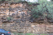
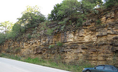
" Brazos River Sandstone and Conglomerate.
— The lowest of the thick sandstones, which are much the most prominent
feature of the Mineral Wells formation, occurs about 300 feet above the
base of the formation. It is a very prominent ledge of thick,
massive sandstone and produces a striking escarpment. From widely
distributed exposures along the Brazos River, but especially the high
cliff at Inspiration Point, eight miles due south of Mineral Wells, the
sandstone is designated the Brazos River member. Typical outcrops are
observed near the town of Garner, eight miles east of Mineral Wells along
the Mineral Wells-Fort Worth road, and on the big hill seven miles
southeast of Mineral Wells on the road to Millsap (Plate XI). Its
prominent escarpment may be seen for miles north of the Texas and Pacific
Railway between Gordon and Santo. It forms the cap rock of imposing
mesa-like hills near Gordon.
The thickness of the Brazos River sandstone member is 25 to 50 feet. It is
very massive, coarse-grained, and in places contains lenticular masses of
conglomerate. A typical section of the lower portion of the Mineral Wells
formation showing the Brazos River member is exposed two and one-half
miles northwest of Millsap. "
Paleocurrent study of the Brazos River Sandstone
member of the Garner Formation
" The Brazos River Sandstone is a resistant, commonly
conglomeratic sandstone which on the surface stands out in striking relief
between the relatively incompetent East Mountain Shale above and the
Mingus Shale below.
Cross-bedding, channeling, local thickness variations, and slumping make
it difficult to assign a strike and dip to the unit.
The conglomeratic zone of the Brazos River Sandstone consists of angular
to subangular pebbles of chert, novaculite, shale, and quartzite similar
to the sediments of the Ouachita-Marathon geosyncline."
Palynology of the Garner Formation (Strawn Series)
of North-Central Texas
"The Brazos River Sandstone is 25 to 30 feet thick. It
is massive, cross-bedded, and contains conglomeratic lenses. The
conglomeratic lenses contain a large variety of chert pebbles which are
predominantly light-colored, but some are green, black, yellow, red, and
blue with rare bandings (Hendricks, 1957).
Clastic sediments of the Garner Formation were probably derived from the
Arbuckle Mountains and Electra Arch to the north, Ouachita Mountains to
the north and east, and Marathon Folds and Concho Arch to the south
(Sloan, 1955). " |


 [+]
[+]


 [+]
[+]
