Geology of Denton County, Texas

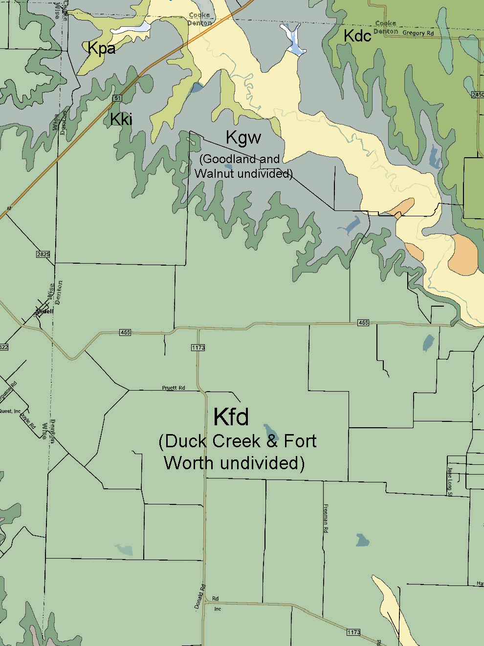
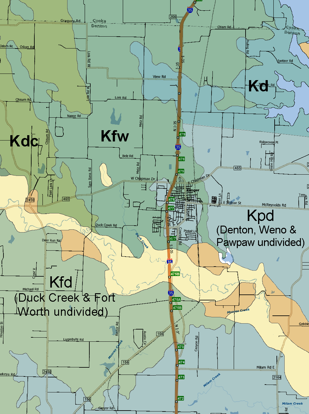
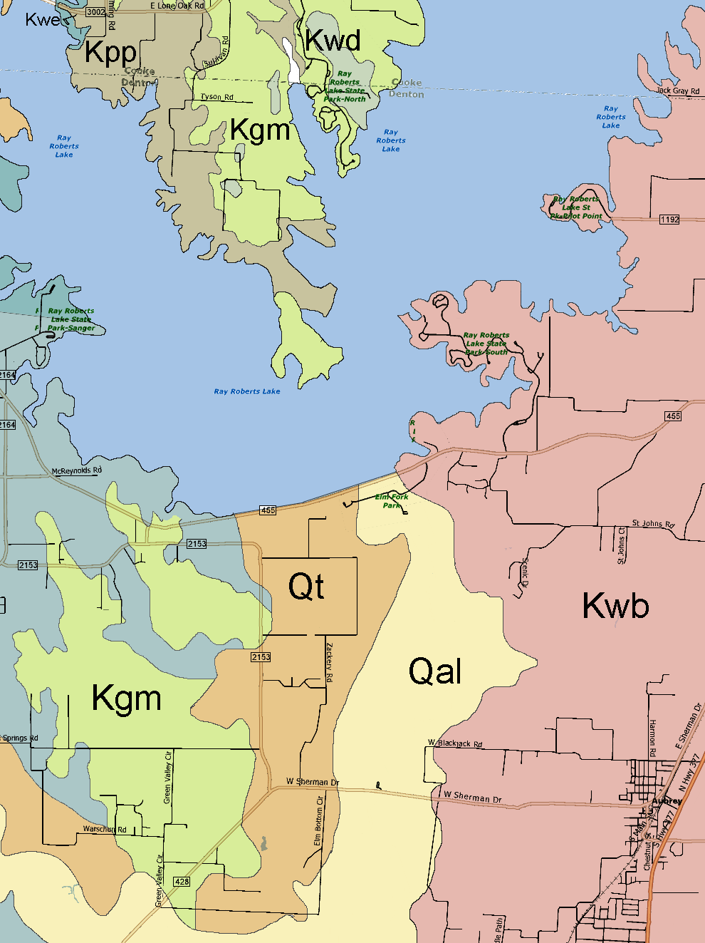
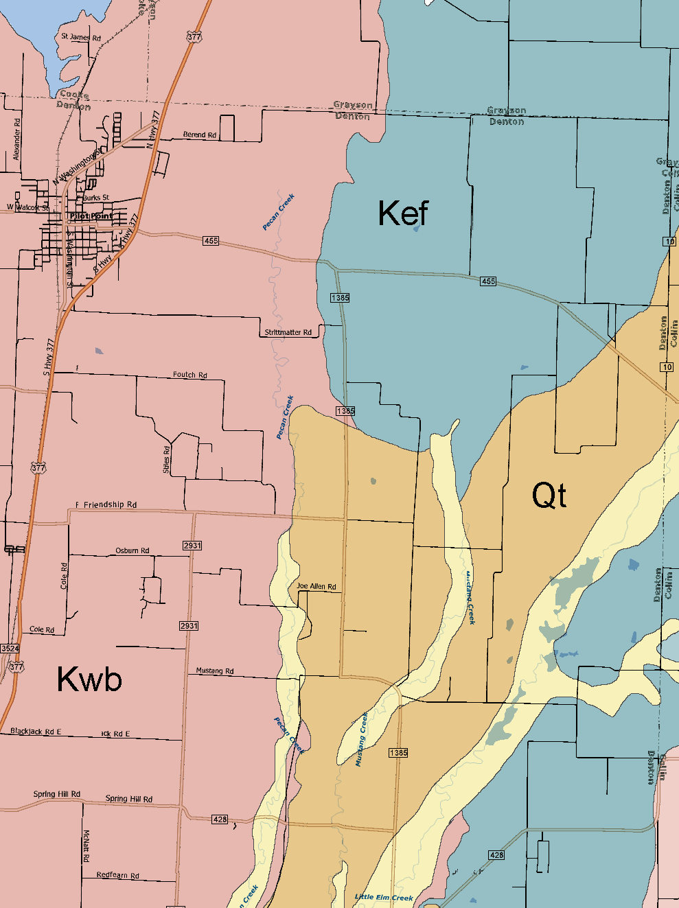
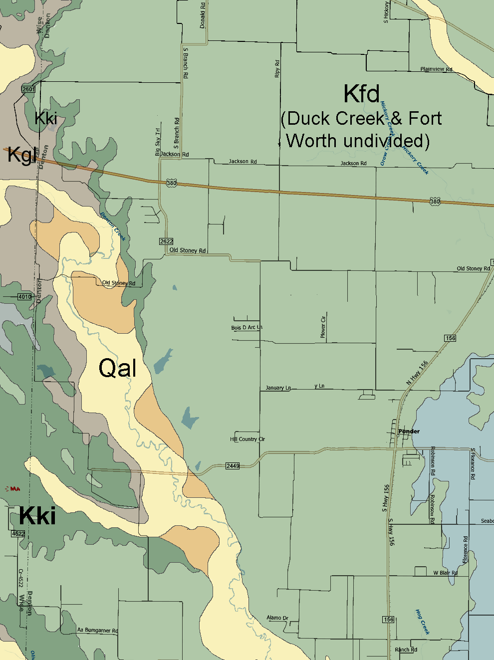
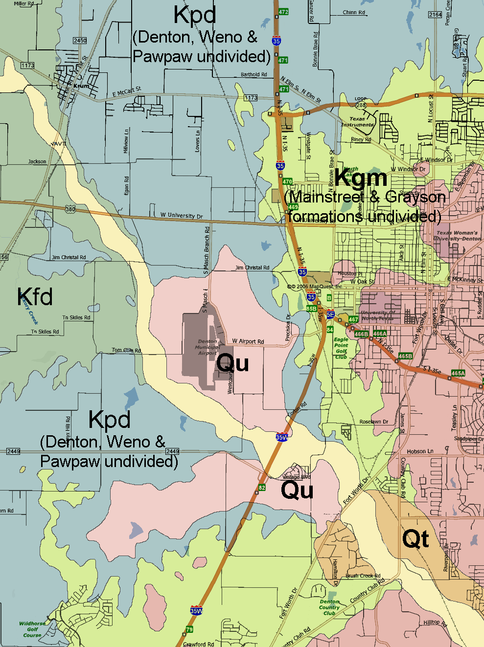
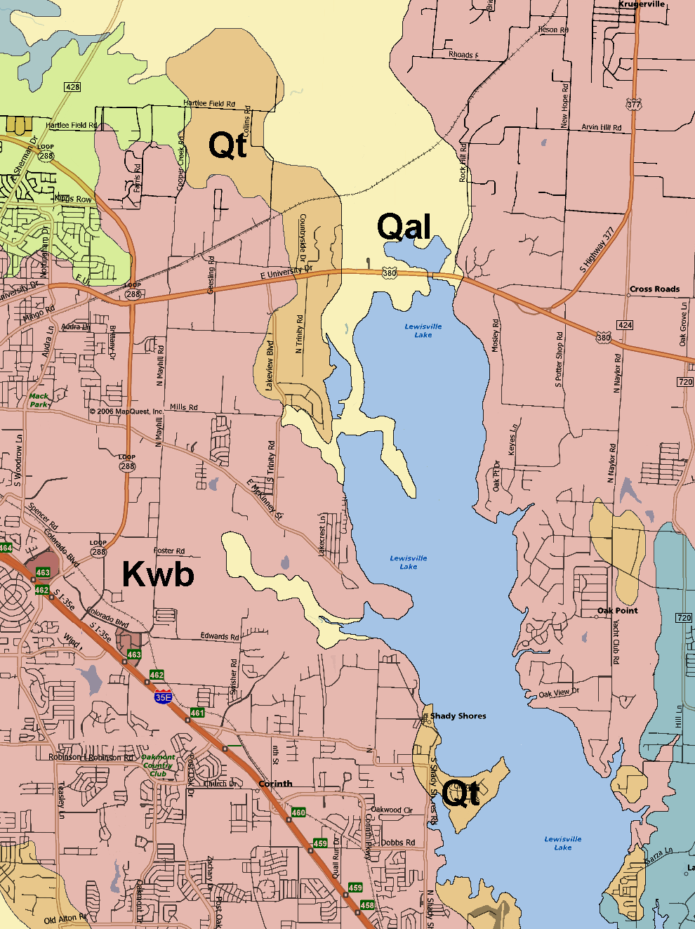
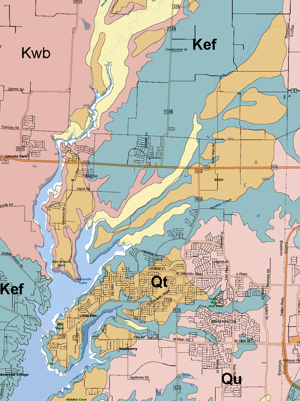
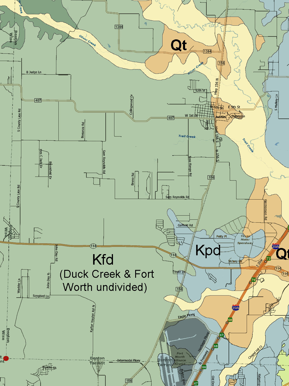
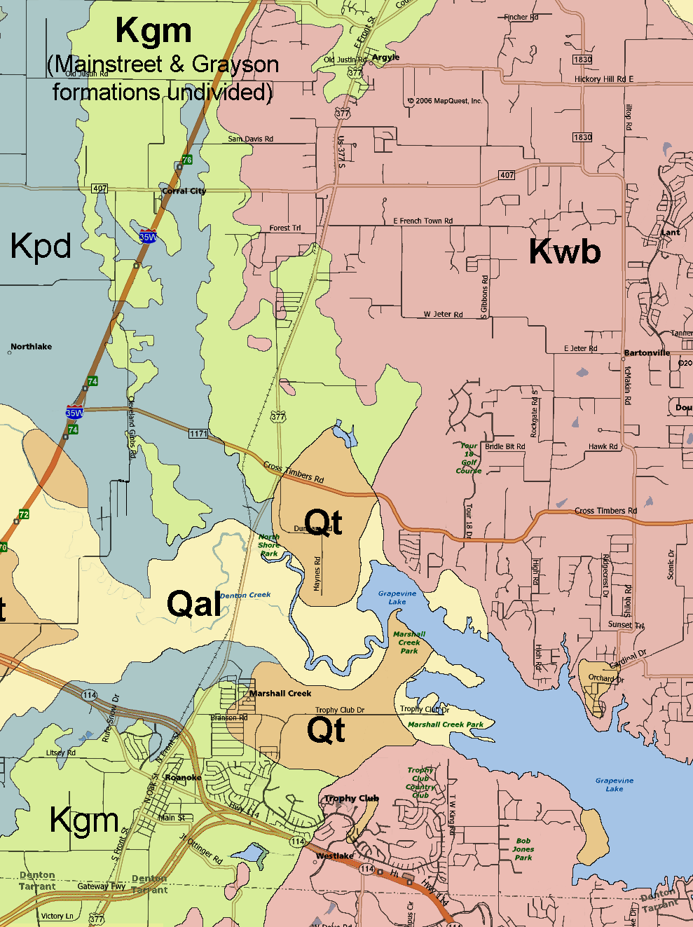
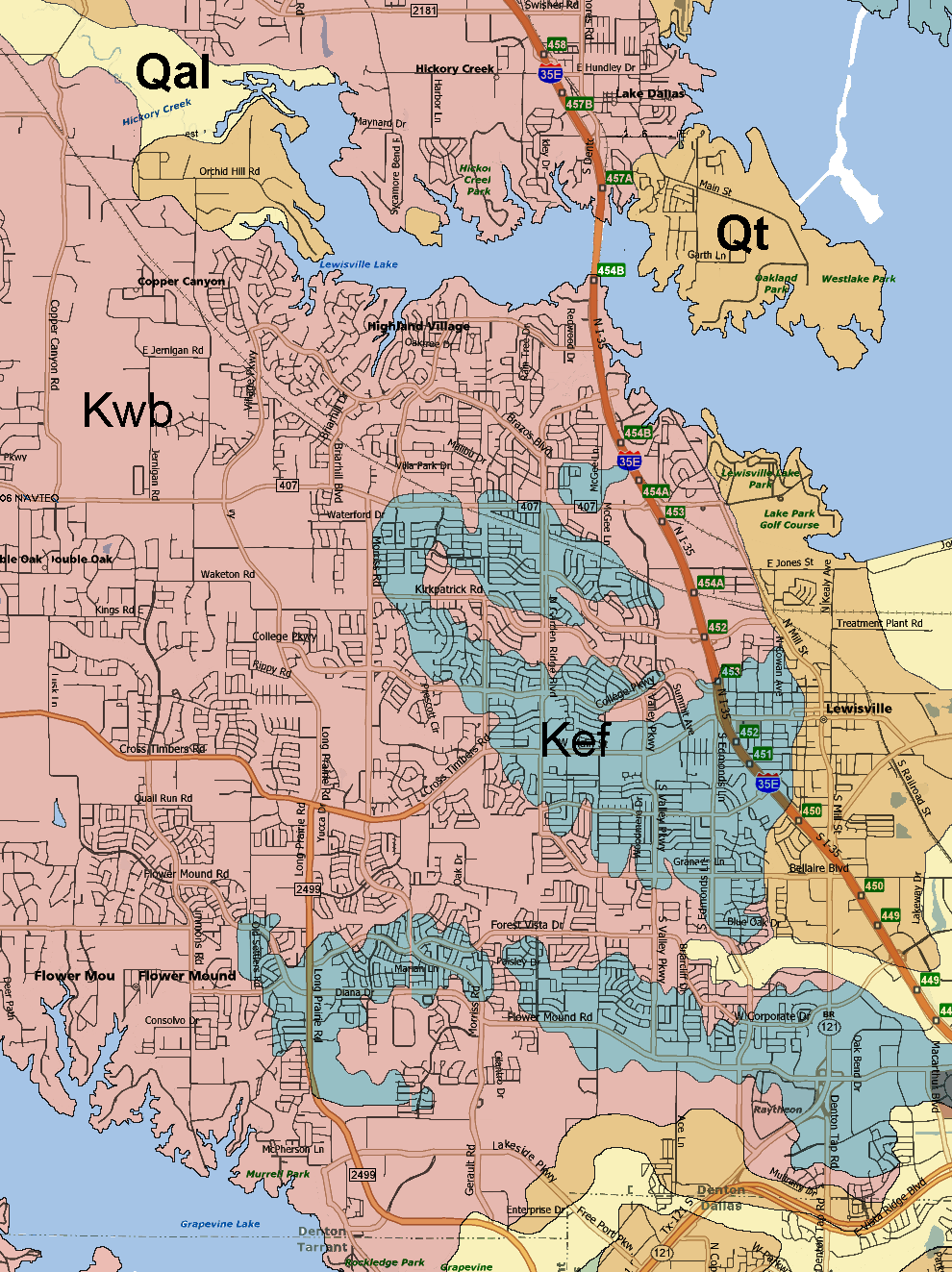
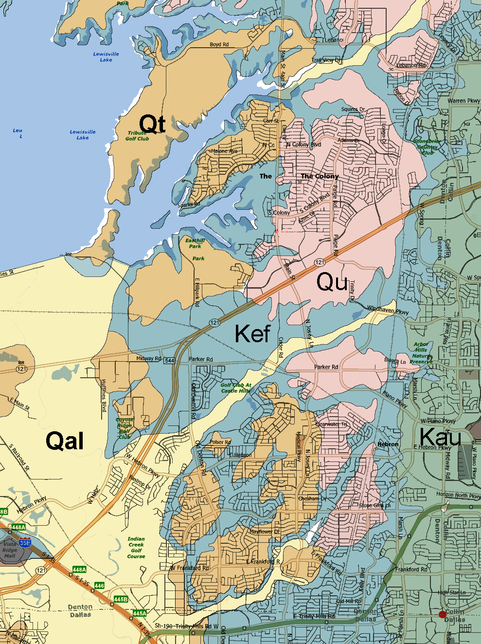
The source geological map used is from "Geological Atlas of Texas, Sherman sheet" - Bureau of Economic Geology, 1967 (revised 1991).  The map was digitally distorted in spots to align the roads with the more accurate modern map.   While most of the roads aligned near perfectly the lakes were skewed or out of scale and could not be reconciled.  Colors used in this map are arbitrary.

Geologic Atlas of Texas - Sherman Sheet descriptive booklet (PDF file - 260k) 

[The best way to print the maps is to save each large image to your computer and then open with the default picture viewer.  This should allow you to print each image and fill a standard 8x11 page without any clipping as may occur if printing from your browser.]

Denton County, Texas geology map in 12 parts:


Geological formations:
Holocene Period: Qal - Quaternary alluvium
Qu - Quaternary undivided
Pleistocene Period: Qt - Quaternary terrace deposits
Cretaceous Period: Kau - Austin Chalk
Kef - Eagle Ford
Kwb - Woodbine
Kgm - Mainstreet & Grayson (undivided on map)
Kpd - Denton,  Weno & Pawpaw Kpp - Pawpaw 
Kfd - Duck Creek & Fort Worth 
(undivided on map)
Kfw - Fort Worth
Kki - Kiamichi
Kgw - Walnut & Goodland (undivided on map)
Kpa - Paluxy sand


Generalized section of sediments in Tarrant and Denton counties.
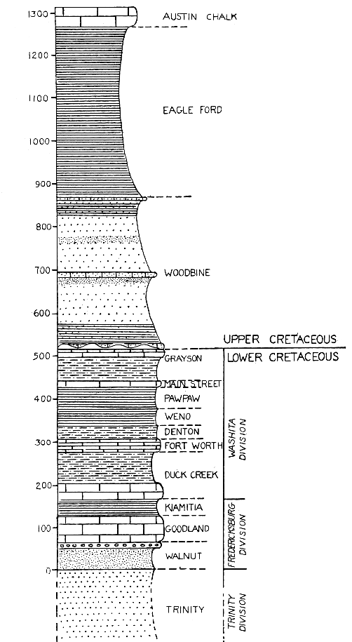
Added: Sep. 6, 2007
Last updated: Dec 25, 2007