Geology of Jack County, Texas


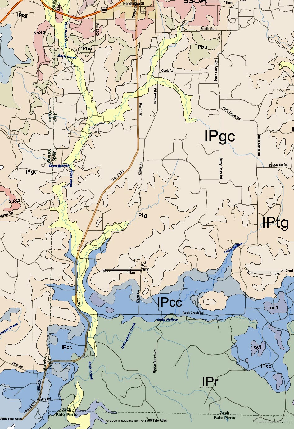
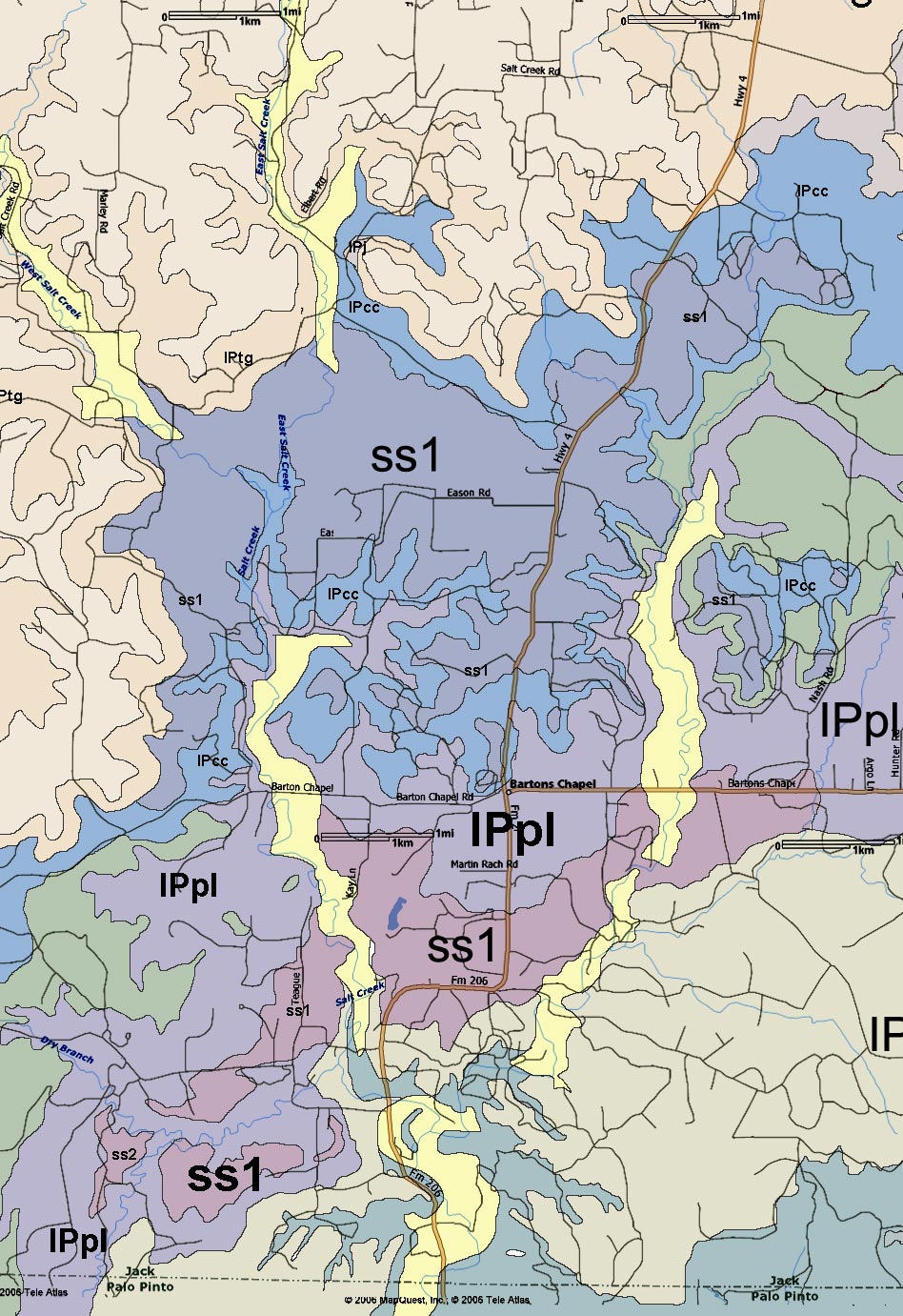
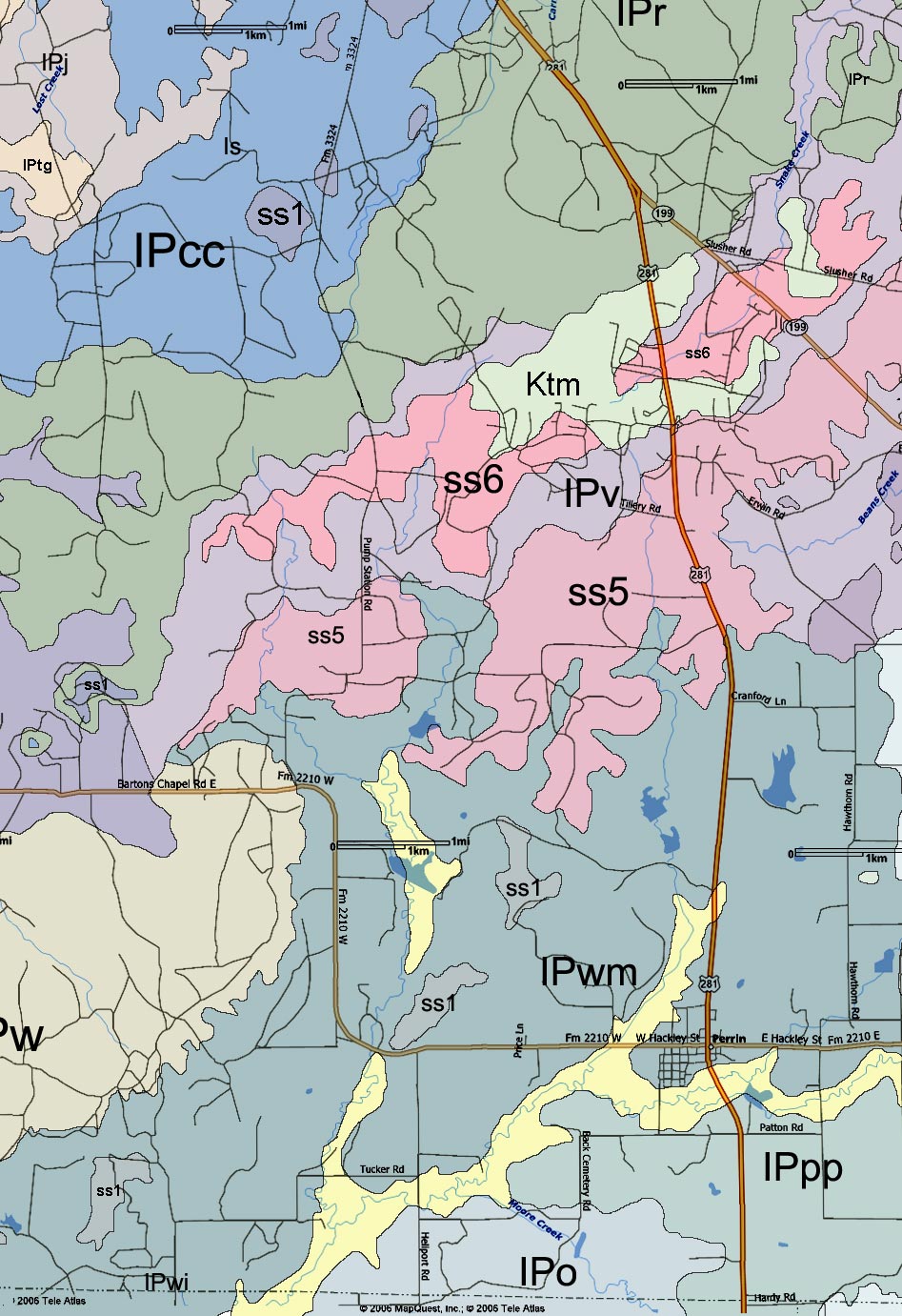
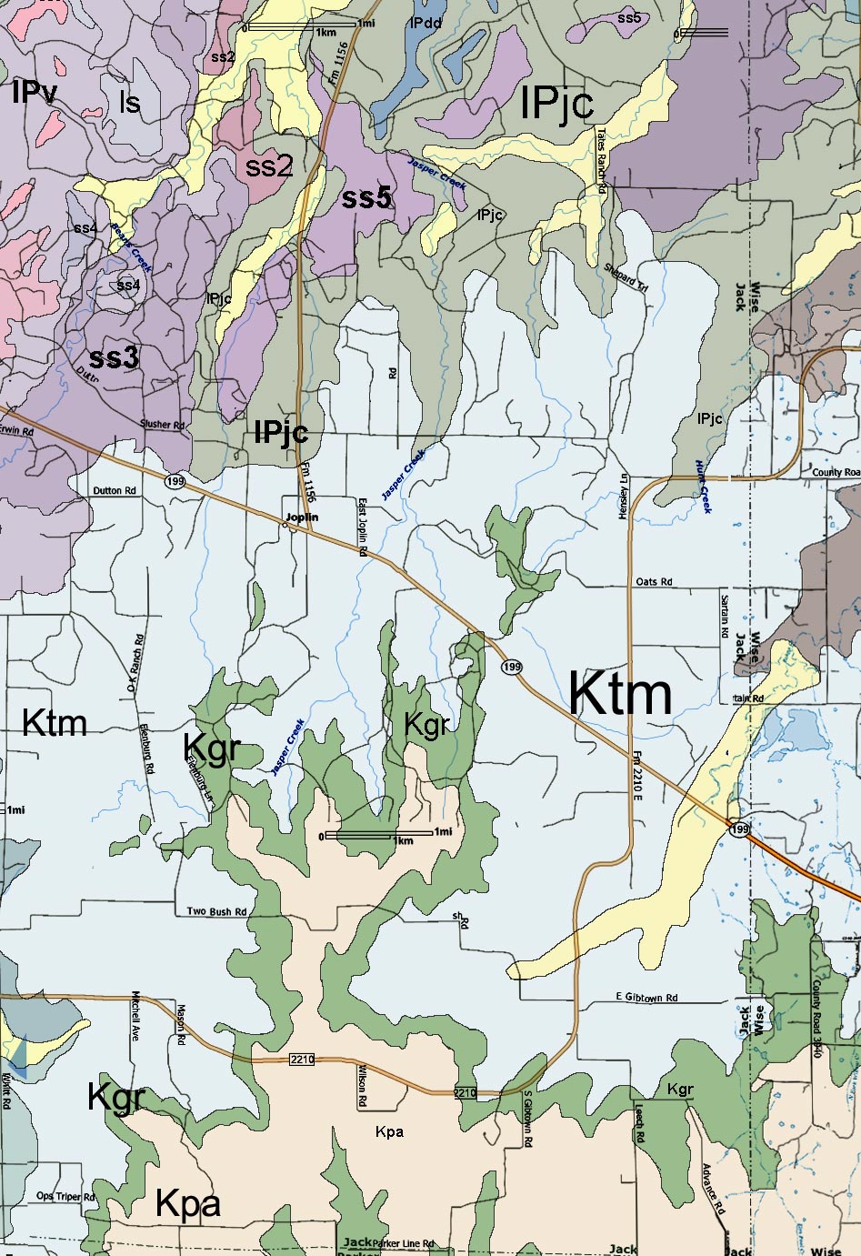
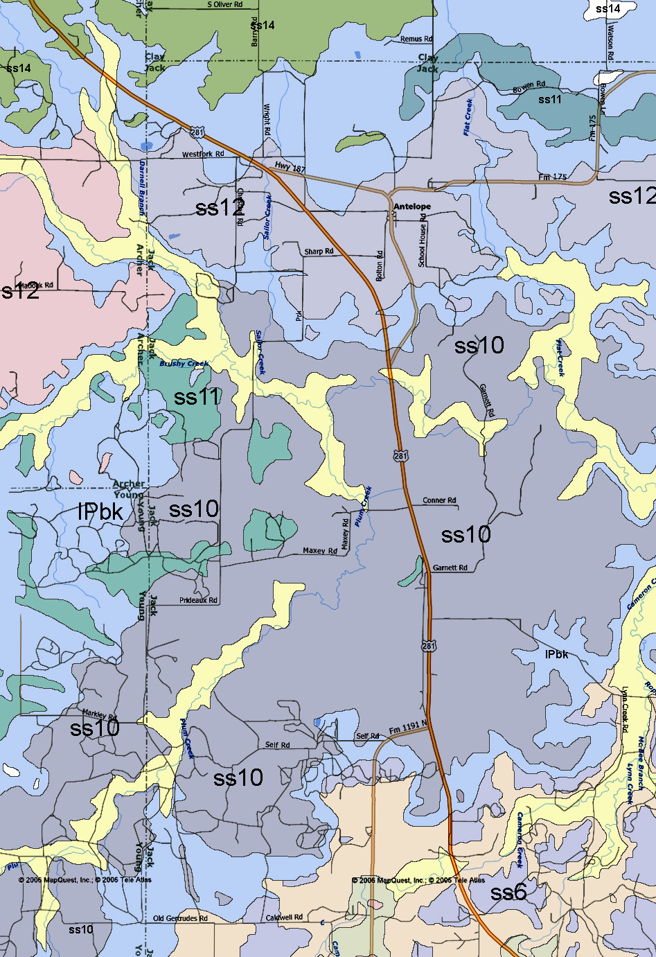
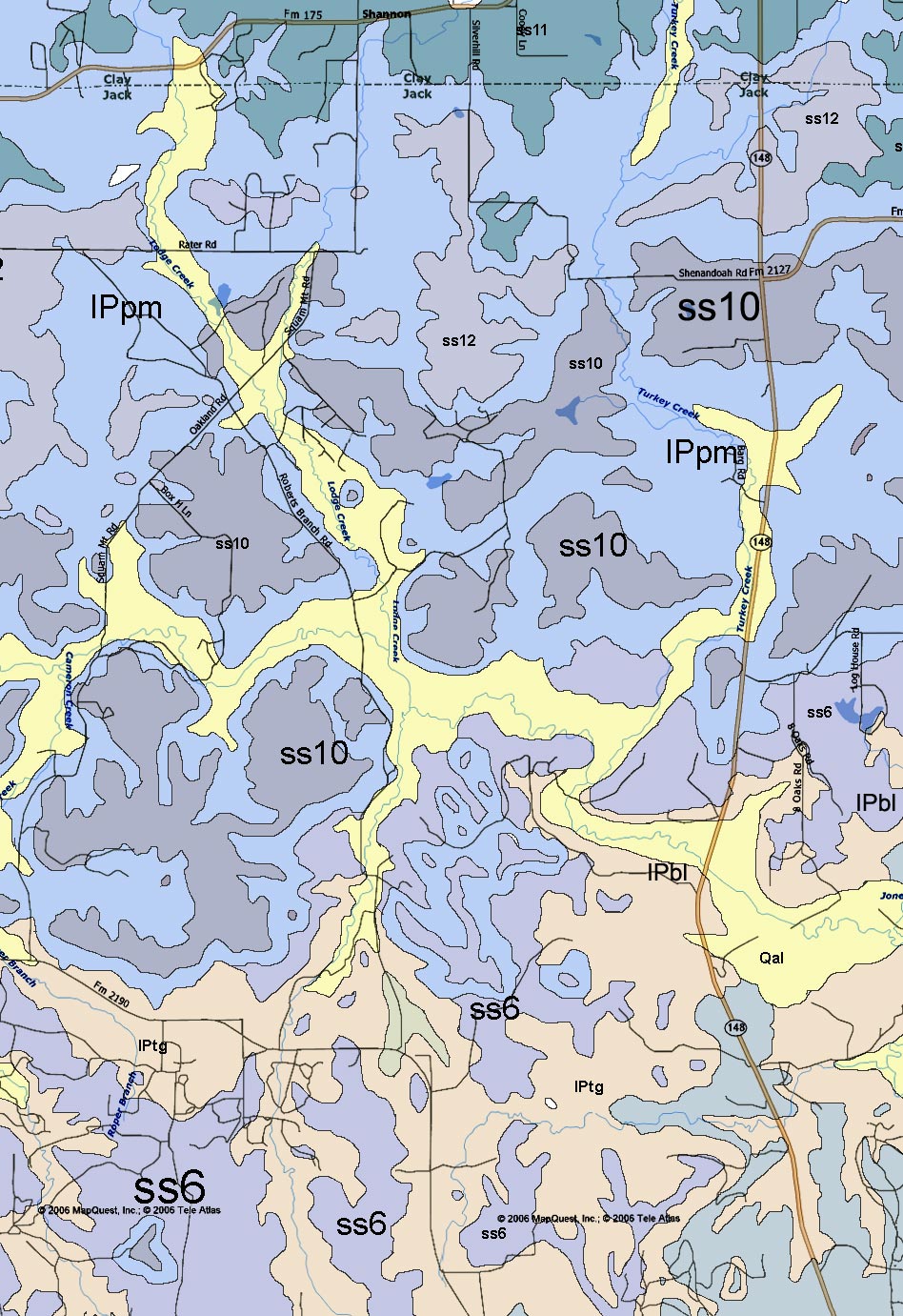
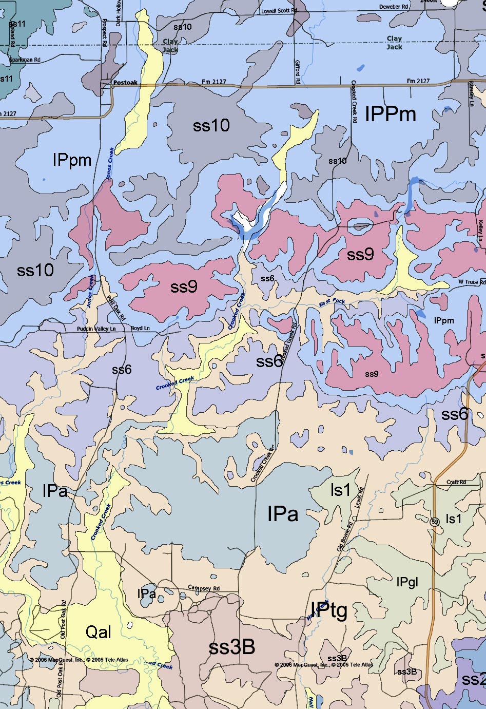
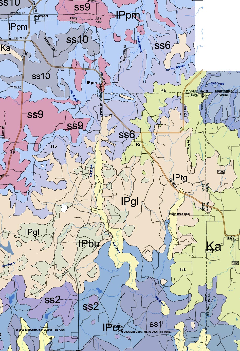
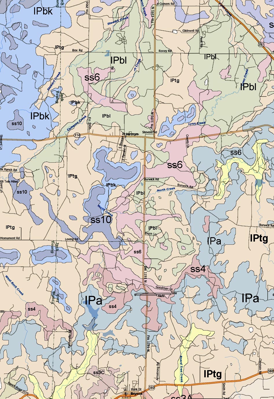
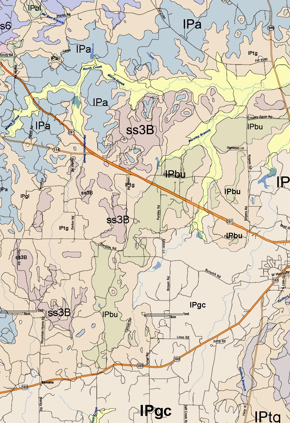
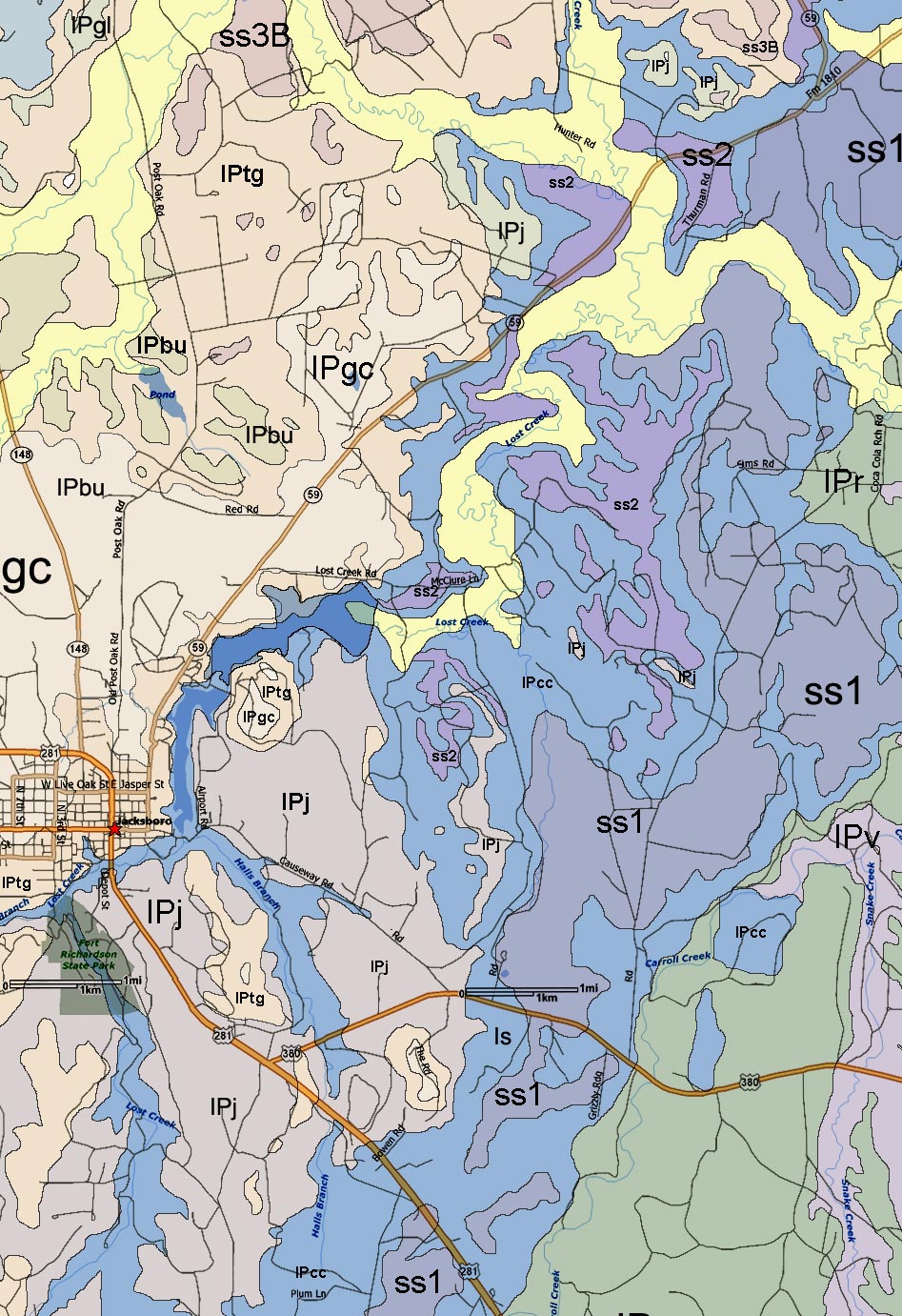
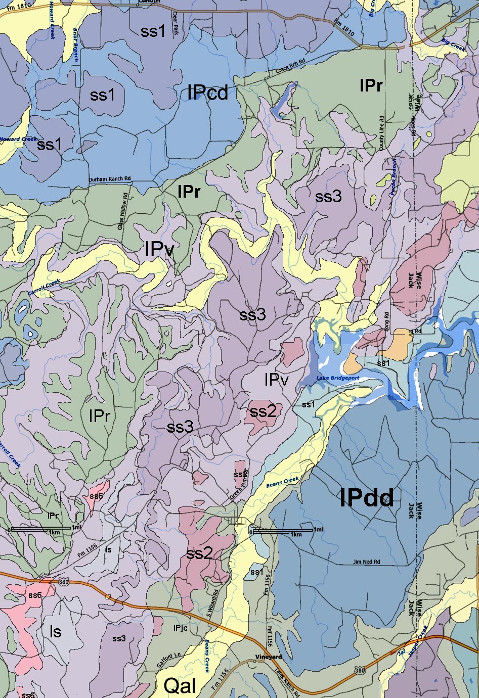
The source geological map used is from "Geological Atlas of Texas, Abilene Sheet" - Bureau of Economic Geology, 1972.  The map was digitally distorted in some spots to align the roads with the more accurate modern map.  Colors used in this map are arbitrary.

Geologic Atlas of Texas - Abilene  sheet descriptive booklet (PDF file - 517k)

[The best way to print the maps is to save each large image to your computer and then open with the default picture viewer.  This should allow you to print each image and fill a standard 8x11 page without any clipping as may occur if printing from your browser.] 

Jack County Geological Map in 12 parts:


Geological Formations and members:  
(greatly simplified)
Formation Member
IPPm - Markley ss5-14 - sandstone and shale
IPbk - Breckenridge limestone
IPtg - Graham and 
Thrifty Formations
IPbl - Blach Ranch limestone
ss4 - sandstone and shale
IPa - Avis sandstone
   "Wayland shale"
IPgl - Gunsight limestone lower
ss2 ss3
IPbu - Bunger limestone 
ss1 - sandstone and shale
IPgc - Gonzales Creek
IPj - Jacksboro limestone
    "Finis shale"
IPcc - Colony Creek shale  ss1 ss2
IPcd - Cundiff limestone
IPr - Ranger Limestone IPr - Ranger Limestone
IPv - Ventioner ls - limestone
ss1 ss2 ss3
IPjc - Jasper Creek
IPcr - Chico Ridge 
IPdd - Devil's Den limestone
IPrh - Rock Hill limestone
IPw - Winchell limestone  
IPwm - Wolf Mountain   
IPpp - Palo Pinto  IPo - Oran sandstone