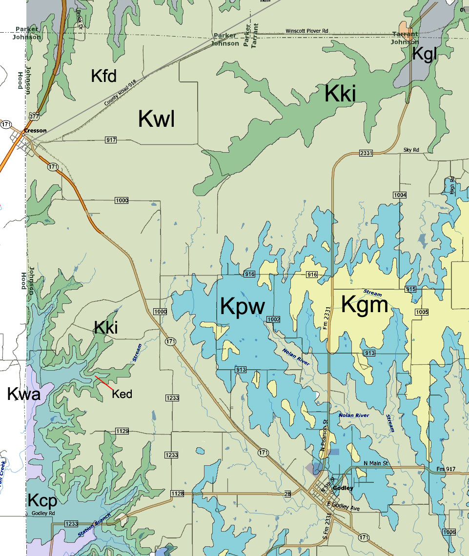
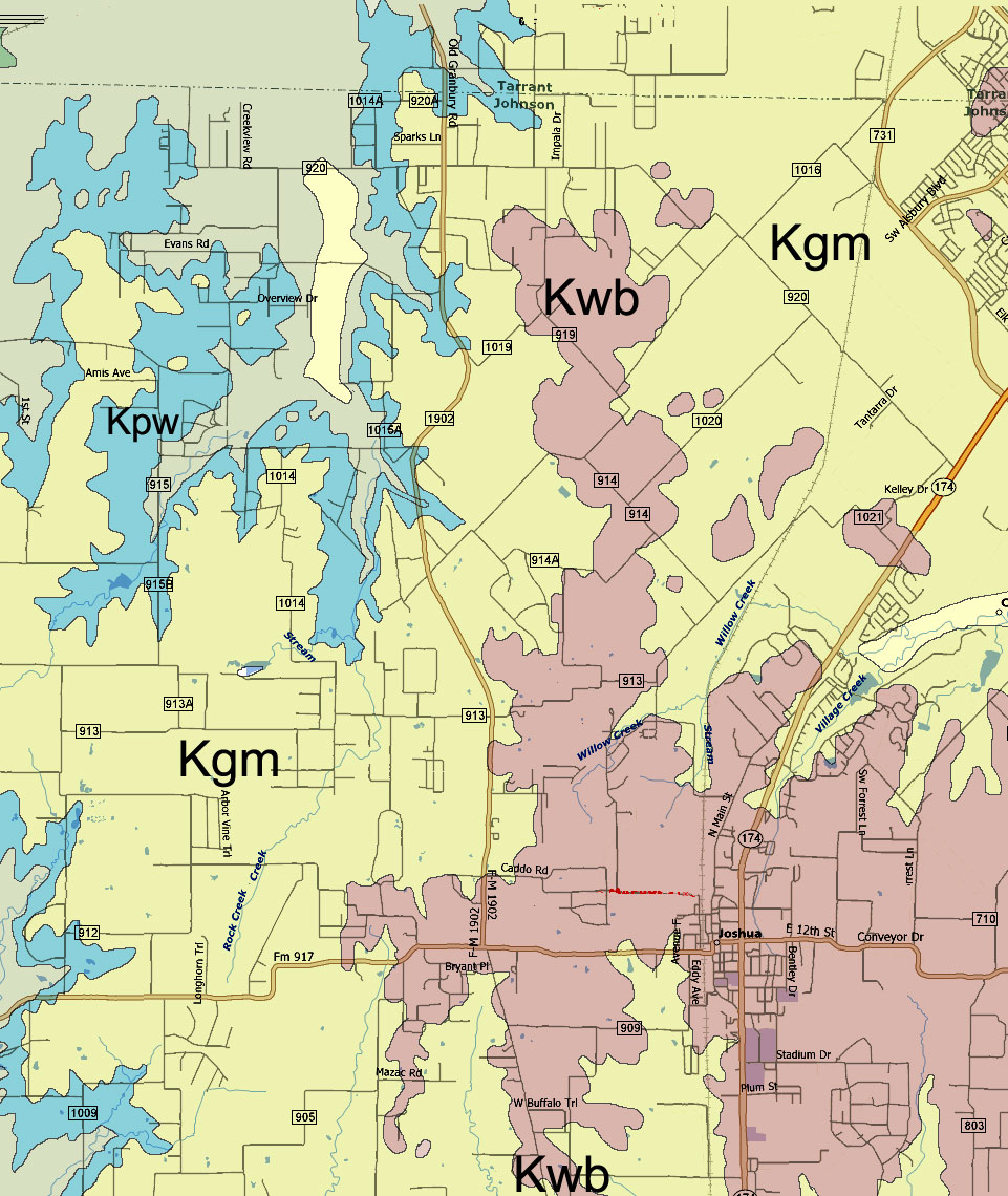
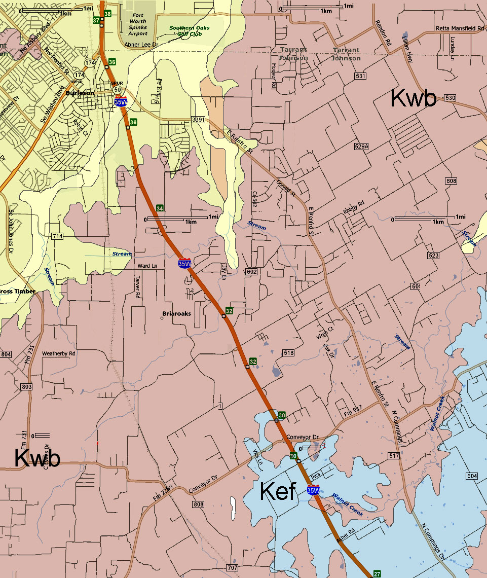
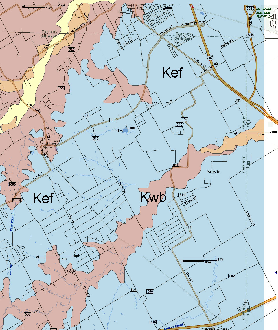
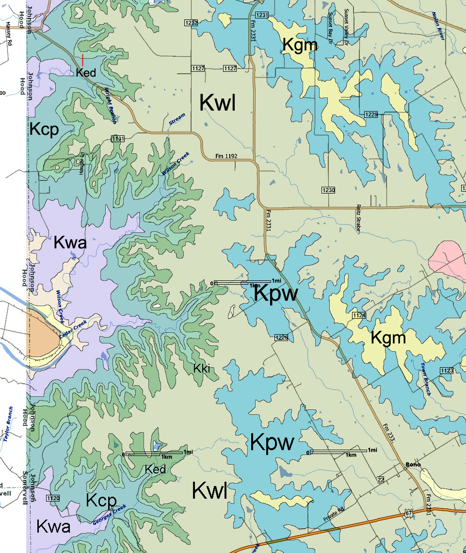
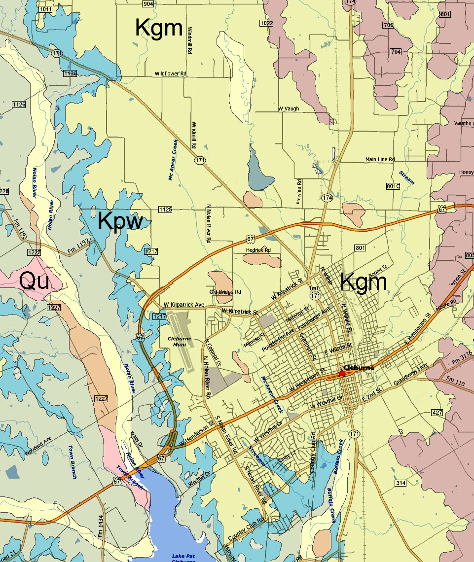
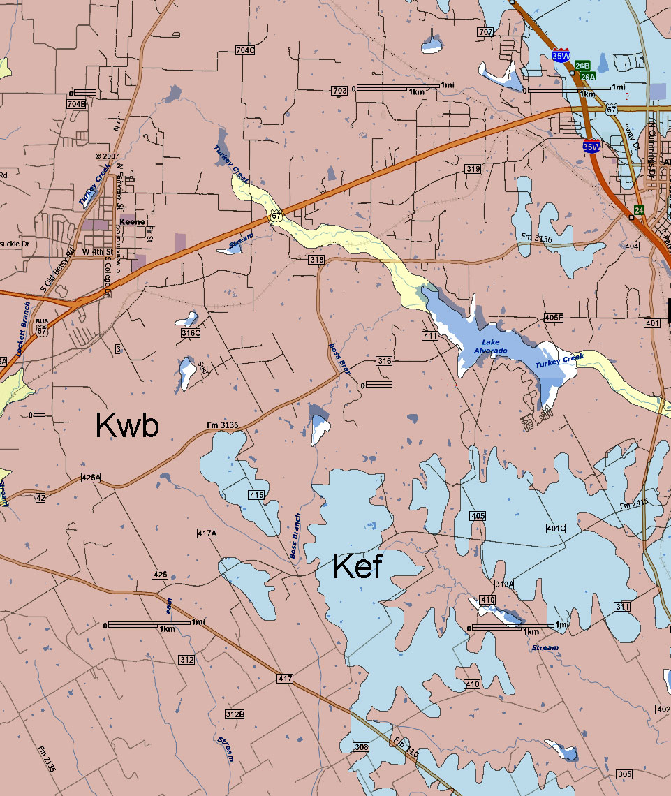
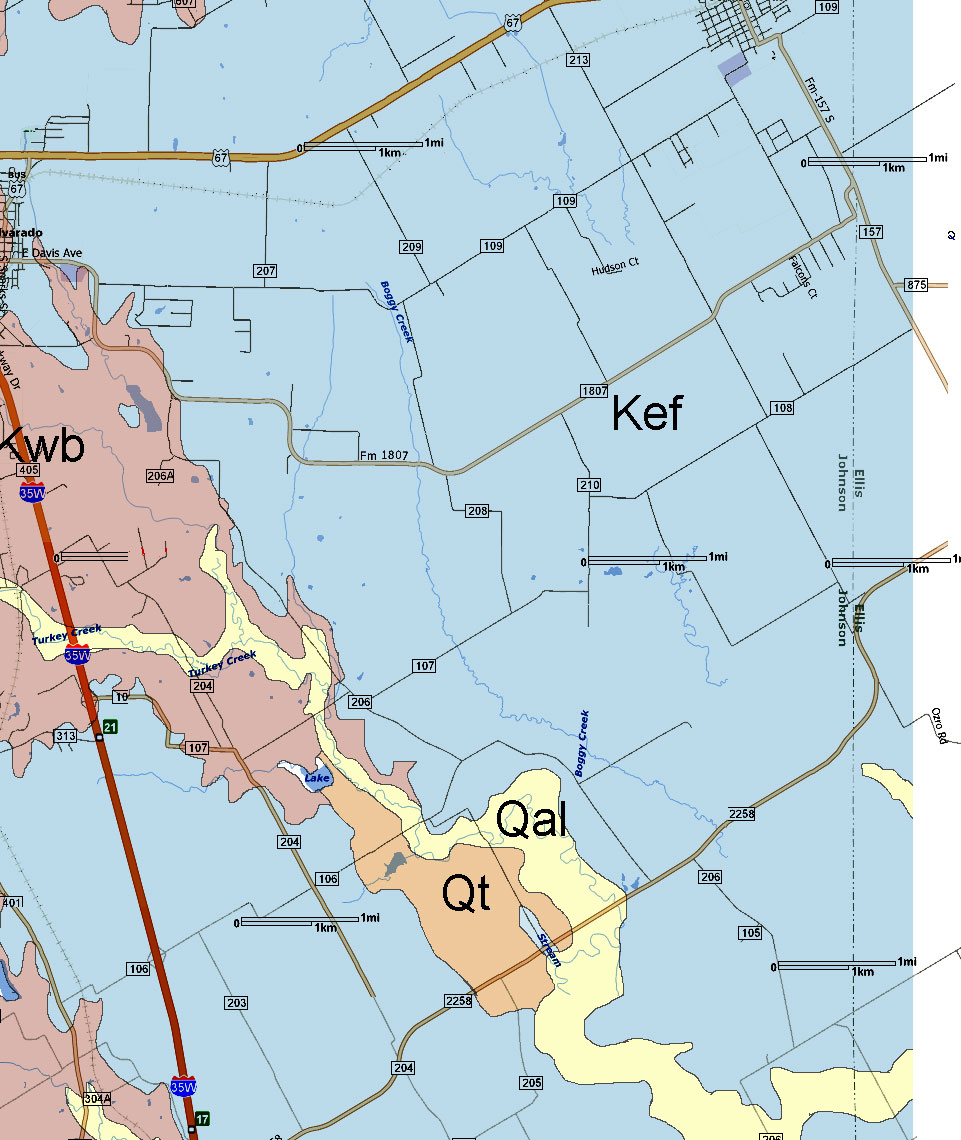
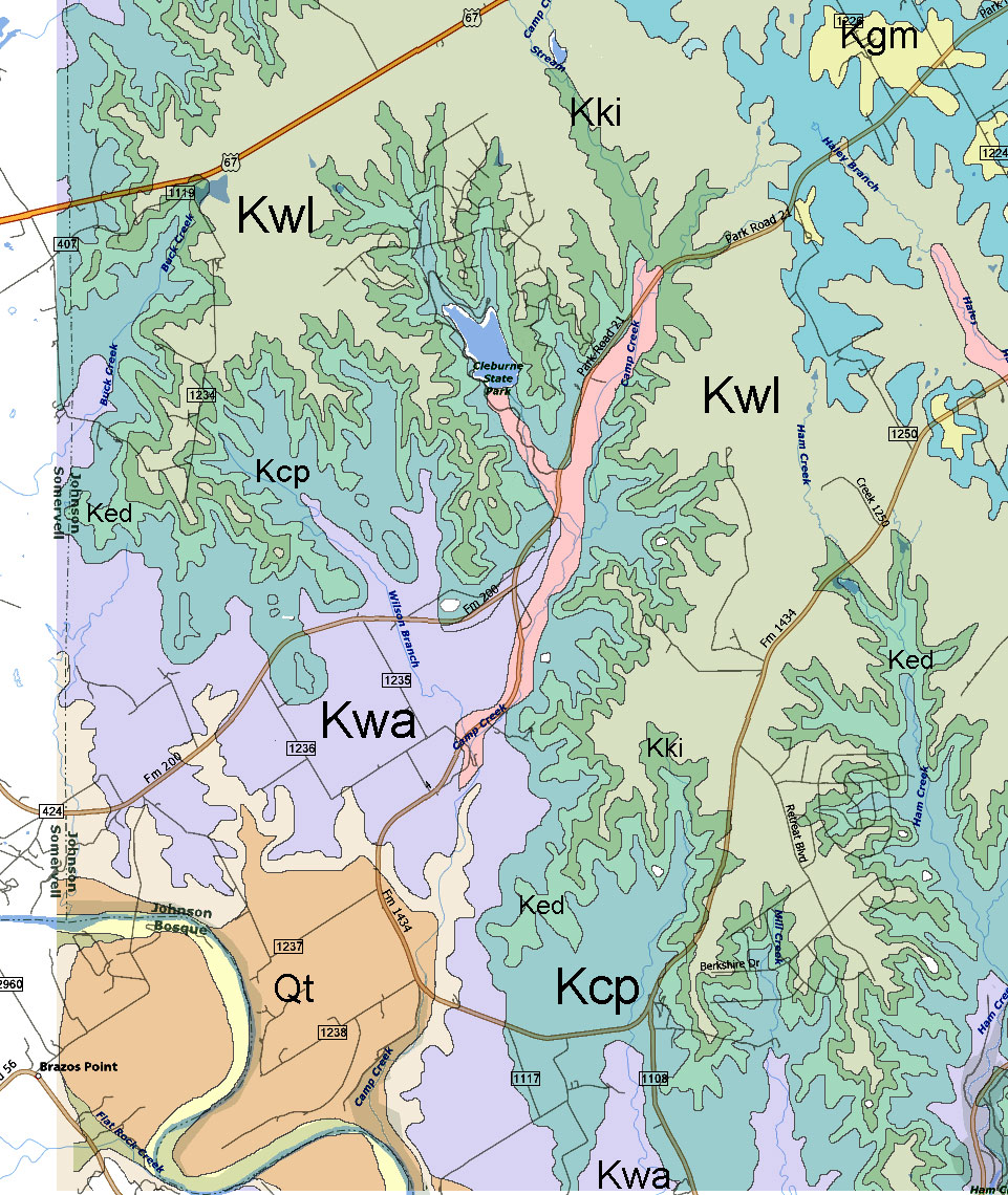
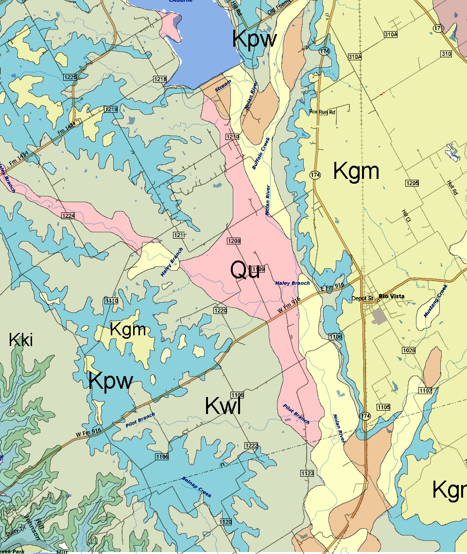
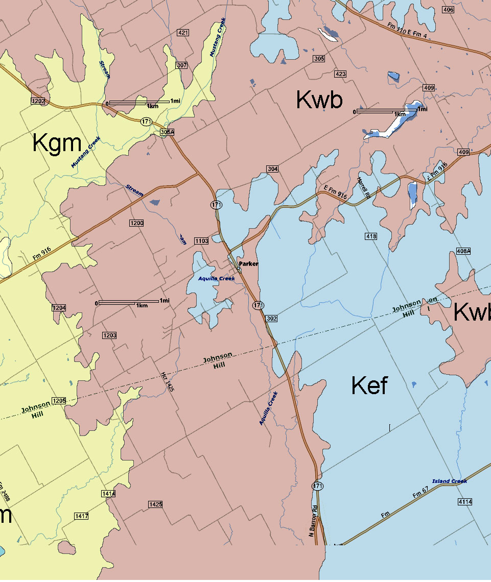
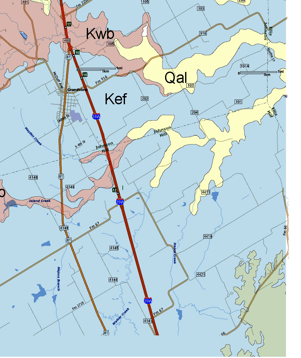
The source geological map used is "Geologic Atlas of Texas,
Dallas Sheet" - Bureau of Economic Geology, 1987. The map
was digitally distorted in some spots to align the roads with the more
accurate modern map BUT there is still some distortions and alignment is
not perfect. Colors used here are arbitrary.
Johnson
County Geologic Map PDF - Right click and "save
as" to your computer (3.5 meg)
[The best way to print the maps is to save each large image to your computer and then open with the default picture viewer. This should allow you to print each image and fill a standard 8x11 page without any clipping which may occur if printing from a browser.]
 |
 |
 |
 |
 |
 |
 |
 |
 |
 |
 |
 |