| Period: |
Formation: |
members
and lenses: |
| Holocene
Period: |
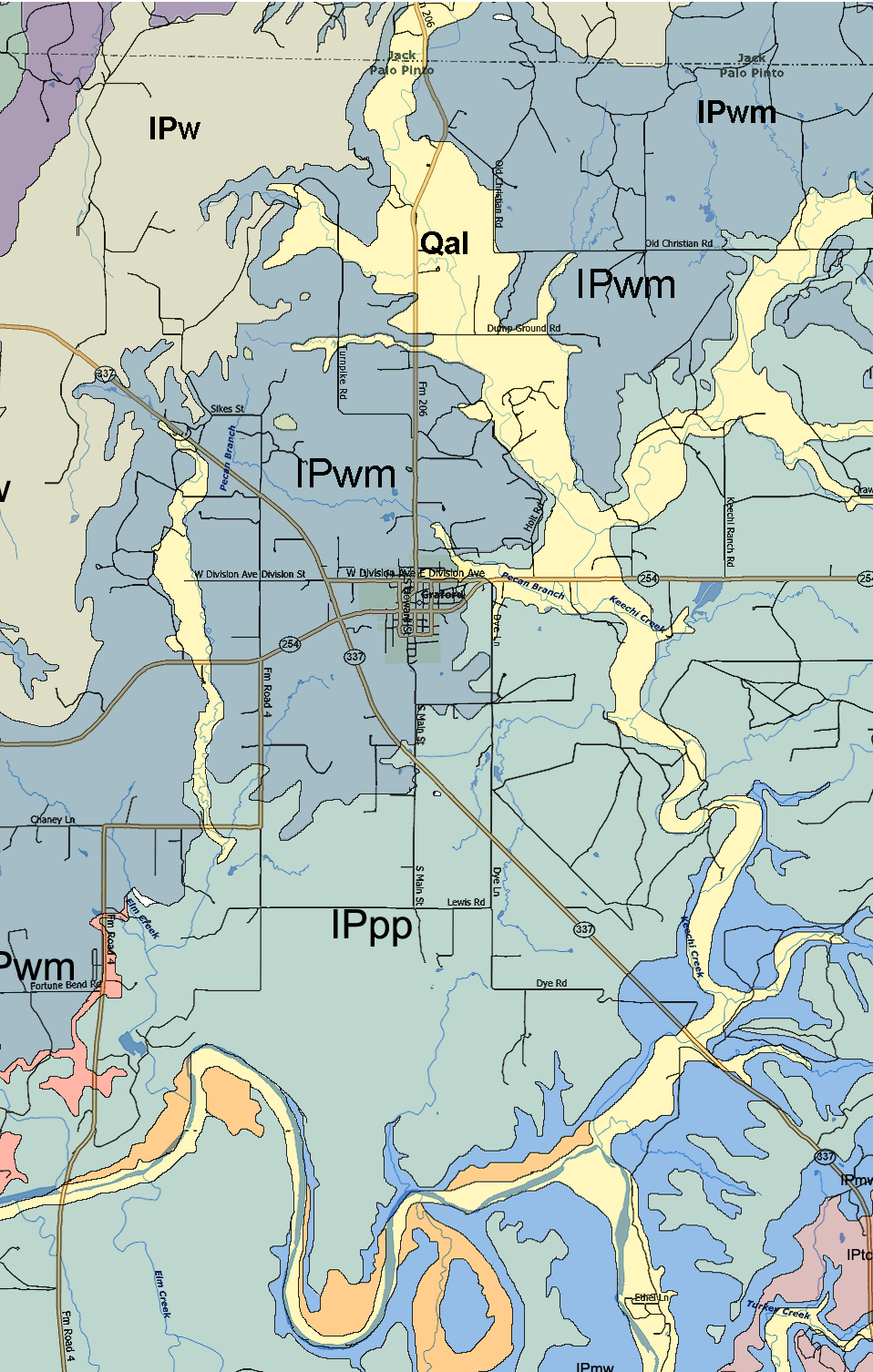
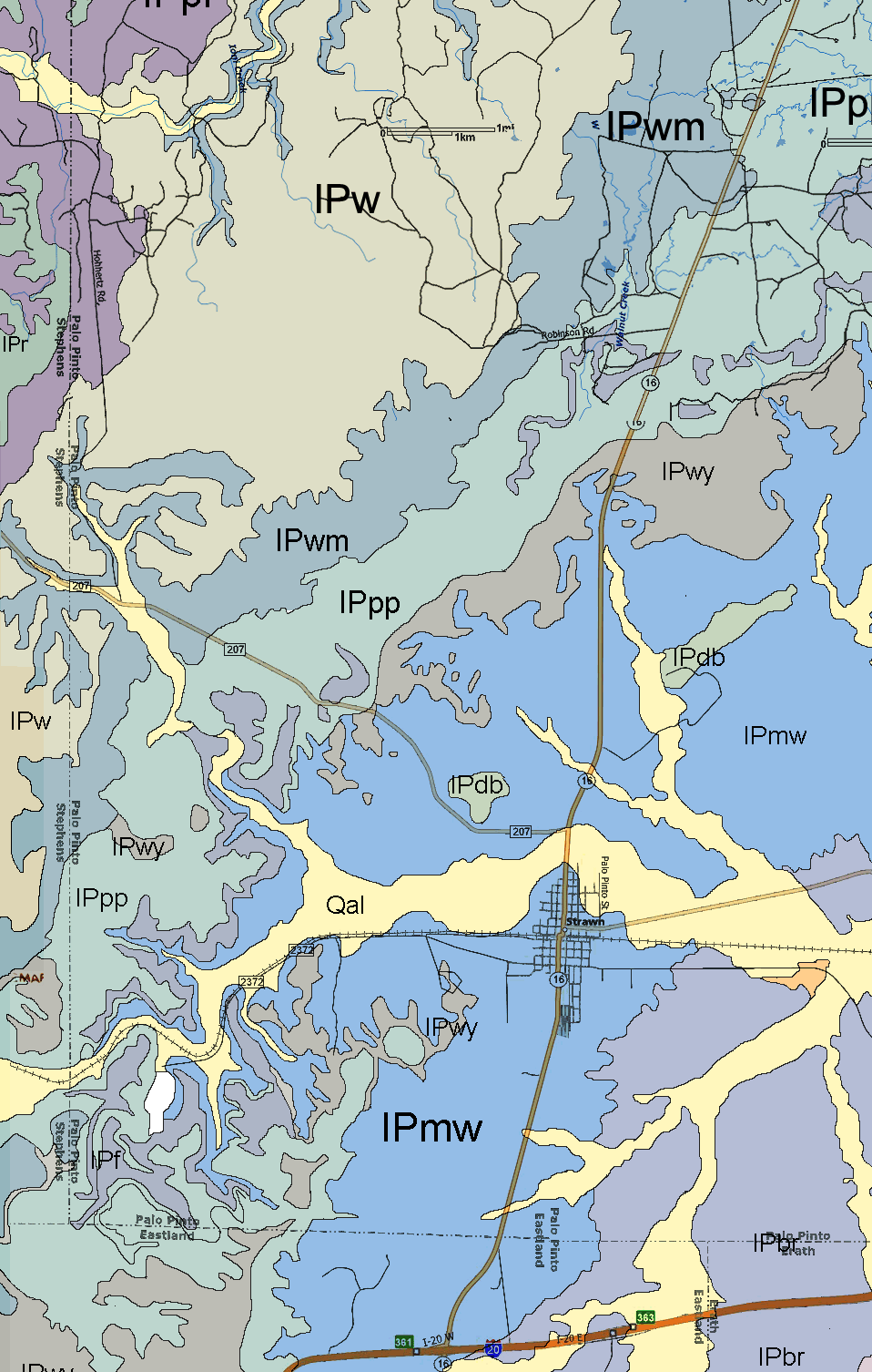
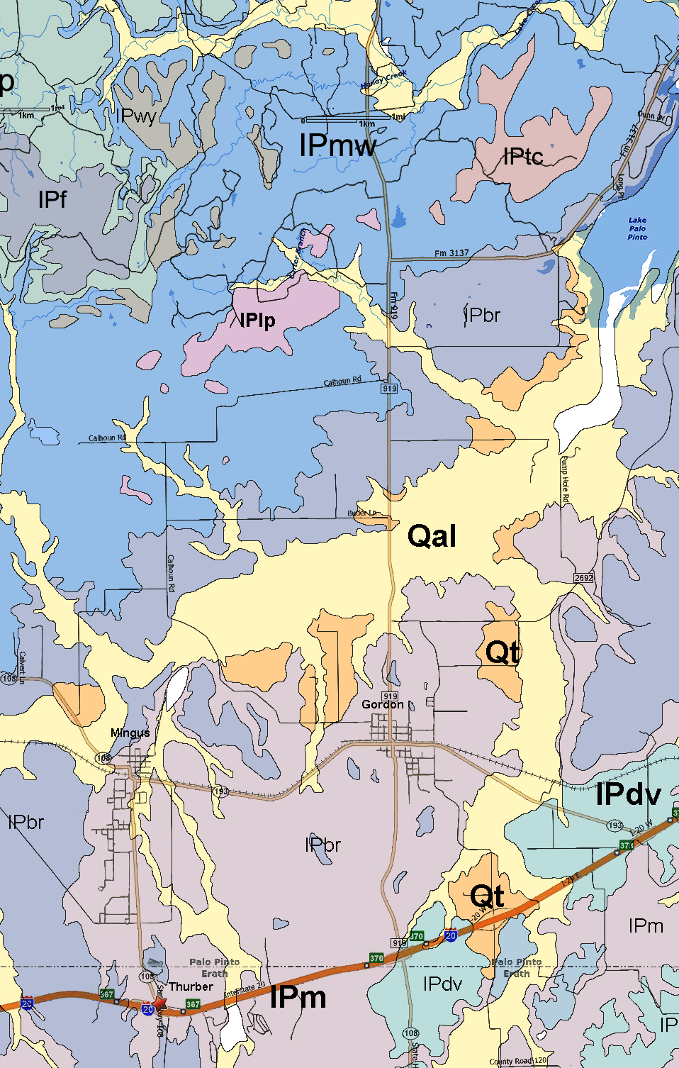
Qal
- Quaternary alluvium |
|
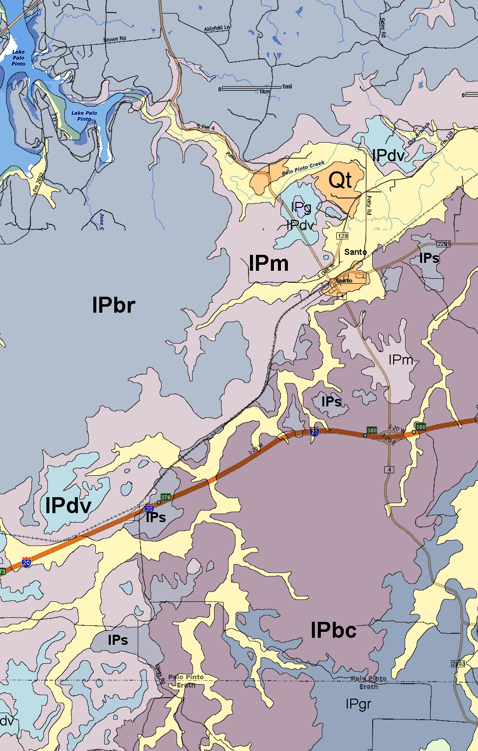
| Pleistocene
Period: |
Qt
- Quaternary terrace deposits |
|
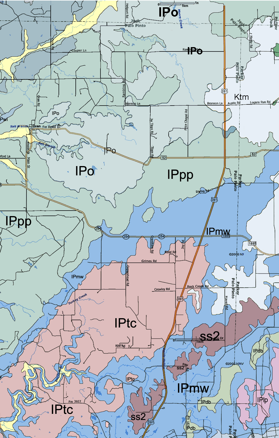
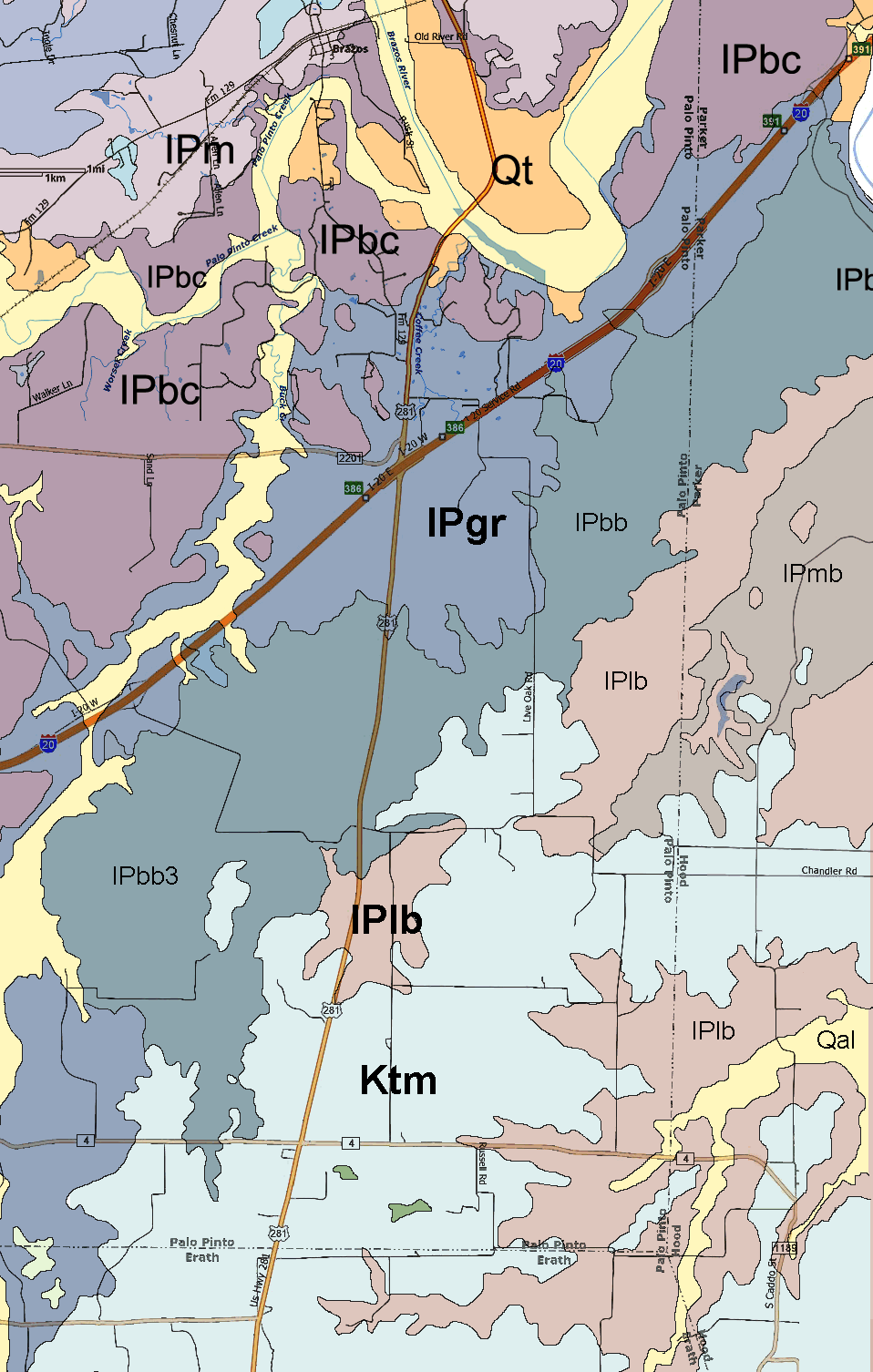
| Cretaceous
Period: |
Ktm
- Twin mountains |
|
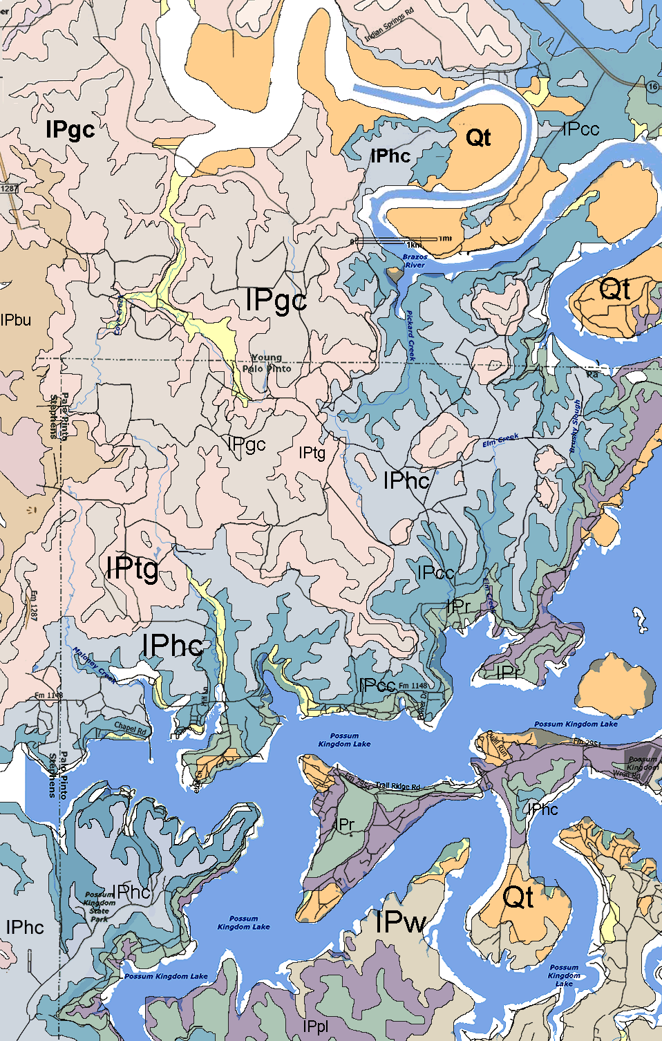
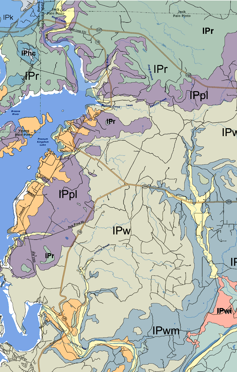
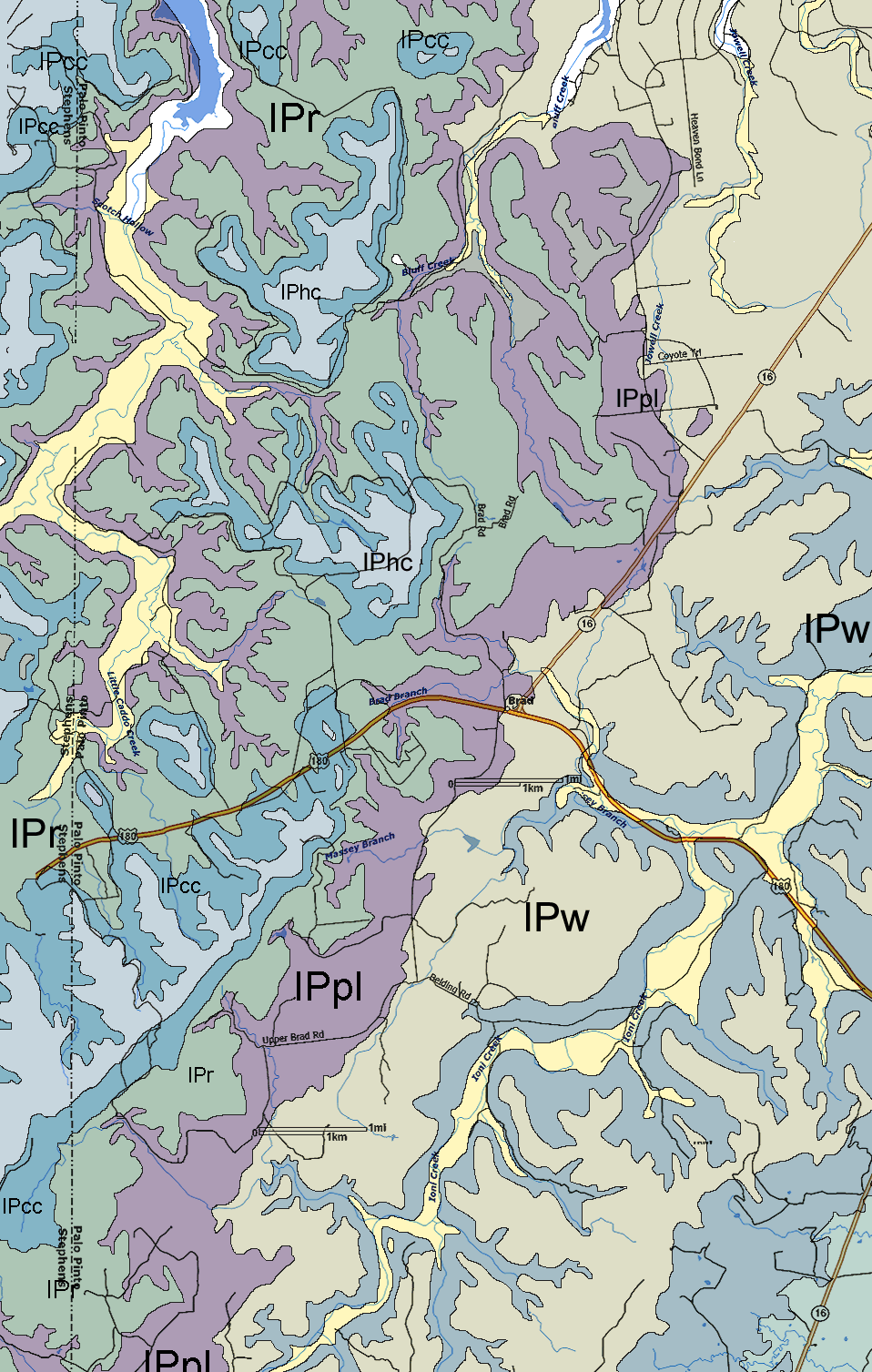
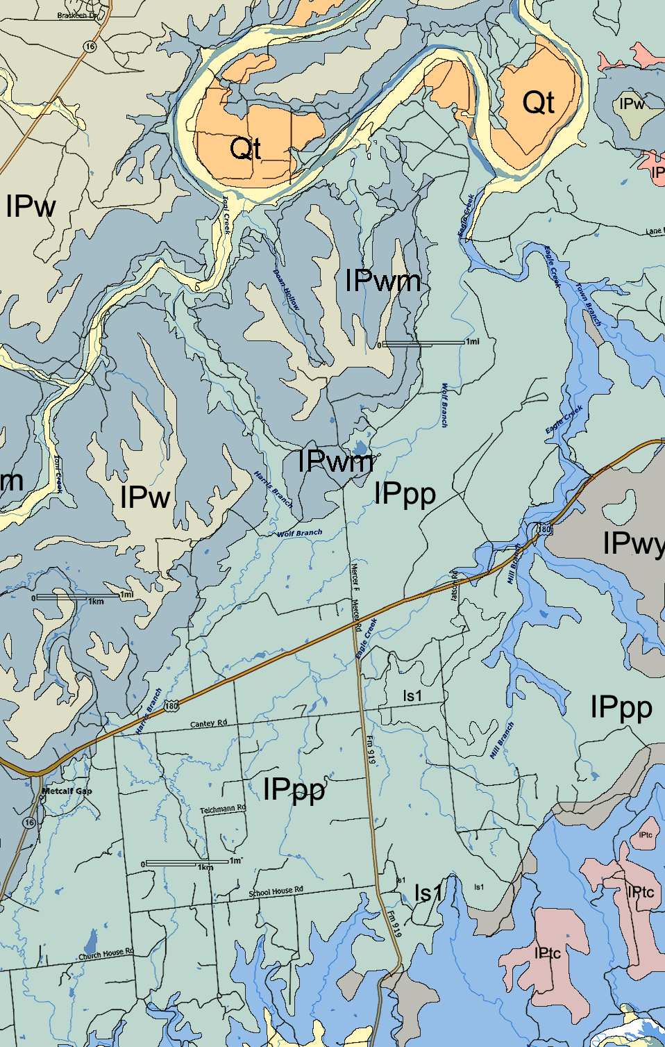
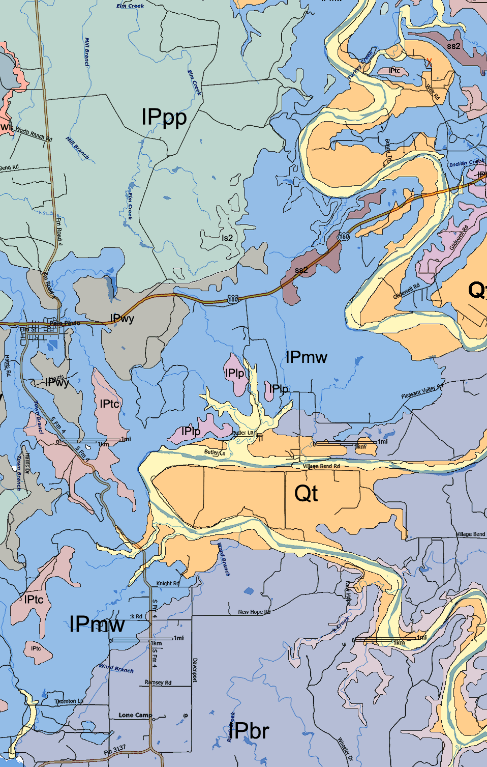
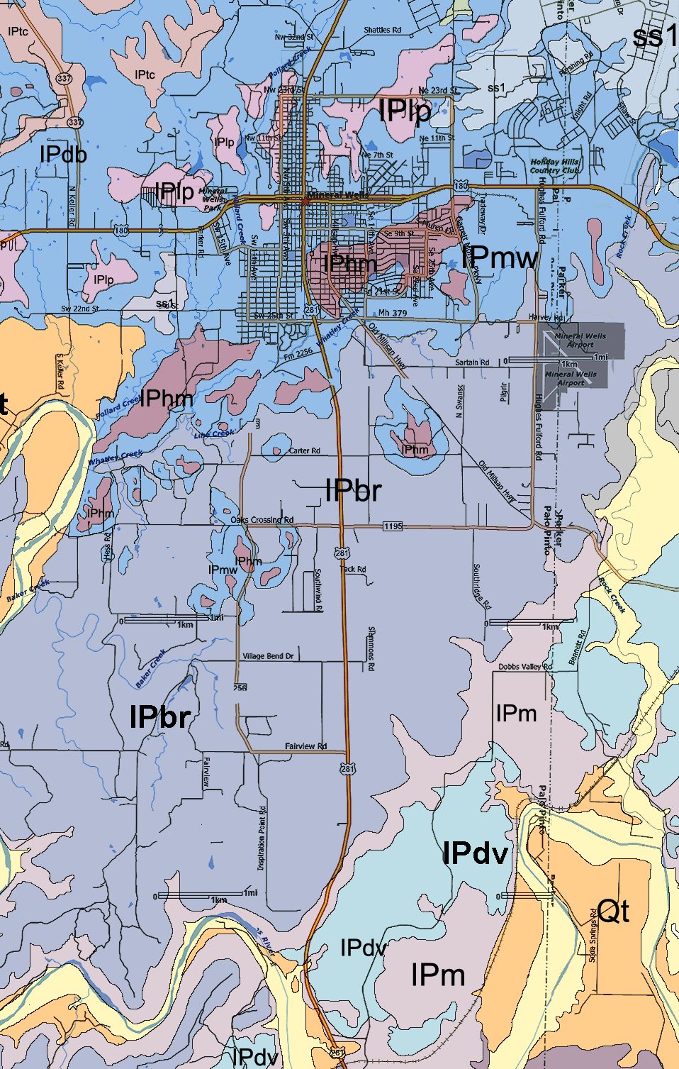
Pennsylvanian
Period: |
IPtg
- Graham and
Thrifty Formations |
| IPbu - Bunger
limestone |
| IPgc - Gonzales Creek
shale |
| IPhc - Home
Creek |
(limestone and shale) |
| IPcc - Colony
Creek shale |
(shale and sandstone) |
| IPr - Ranger
Limestone |
(limestone and shale) |
| IPpl -
Placid shale |
(shale, sandstone and
limestone) |
| IPw -
Winchell limestone |
(limestone and shale) |
| IPwm -
Wolf Mountain |
(shale, sandstone and
limestone) |
| IPpp
- Palo Pinto |
IPwi - Wiles
limestone |
| IPo - Oran
sandstone |
| (limestones 1-6) |
| IPf - Fambro
sandstone |
| IPwy - Wynn
limestone |
| IPmw -
Mineral Wells |
Keechi Creek shale |
IPtc - Turkey Creek
limestone |
| Salesville shale |
IPdb - Dog Bend
limestone |
| East Mountain
shale |
IPlp - Lake Pinto
sandstone |
| IPvb - Village Bend
limestone |
| IPc - Capps limestone |
| ss1 - sandstone |
| IPhm - Hog Mountain
sandstone |
| IPbr -
Brazos River (expanded) |
|
| IPm
- Mingus |
(Thurber coal) |
| IPg - Goen limestone |
| IPdv - Dobbs Valley
sandstone |
| IPs - Santo
limestone |
| IPgr
- Grindstone Creek |
IPbc - Buck Creek
Sandstone |
| IPbb1-3 - Brannon
Bridge Limestones 1-3 |
| IPlb
- Lazy Bend |
IPmb - Meek Bend
Limestone |
| (limestone) |