 (2nd)
(2nd)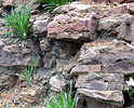
|
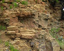
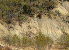
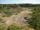
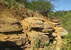
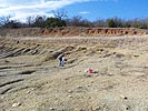
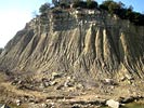
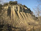
The Geology of Texas - Volume 1 - Stratigraphy The Mineral Wells formation as restricted by Scott and Armstrong consists chiefly of shales, sandstones, and conglomerates. The shales predominate, occurring in beds of 200 or more feet thick. Some thin lenticular limestones are present. The formation includes the following members: East Mountain shale, Lake Pinto sandstone, Salesville shale, Turkey Creek sandstone, and Keechi Creek limestone and shale. The several members thicken to the northeast. The East Mountain shale, about 300 feet thick, includes a thin limestone near the top and is in places highly fossiliferous. The Lake Pinto massive sandstone which caps the escarpment at Mineral Wells is 20 or 25 feet thick. The Salesville shale overlying the Lake Pinto sandstone is about 150 feet thick. It is overlain by the Turkey Creek sandstone, which is 10 or 15 feet thick. The top member of the formation, the Keechi Creek sandstone and shale, is exposed in the escarpment formed by the Palo Pinto limestone. This member is from 100 to 150 feet thick. Locally fossils are abundant and the formation contains a large and varied invertebrate fauna. The Garner and Mineral Wells formations differ from the underlying Millsap Lake formation in that they contain a much larger amount of sandstone and conglomerate. These deposits indicate stronger stream activity than in Millsap Lake time and also more diversified conditions since coal beds and thin, somewhat persistent, limestones are present. Type locality: East Mountain near Mineral Wells in Palo Pinto County; thickness, from 750 to 1800 feet. In the Colorado River valley the Strawn group consists largely of alternating beds of sandstone and shale. The entire group represents near-shore deposits, the sediments having come, not from the nearby Central Mineral region, but from a land mass to the east or northeast now concealed. The combined thickness of these units is 3500 or 4000 feet. The beds overlap to the west so that the actual thickness of the Strawn is much less than that, probably not in excess of 1200 feet at any one locality. Drake (449) described and assigned names to these successive beds, recognizing the following units: Lynch Creek, Burnt Branch, Elliott Creek, Shadrick Mill, Bed No. 8, Fox Ford, Horse Creek, Bull Creek, Big Valley, Brown Creek, Spring Creek, Cottonwood Creek, Hanna Valley, Rough Creek, Buffalo Creek, Wilbarger Creek, Comanche Creek, Indian Creek, Antelope Creek, and Ricker. The Capps limestone is now regarded as within the Strawn group. This limestone, represented by a coral reef, is well exposed in the old public road, 5 miles East of Brownwood. The Cretaceous covering of the Callahan divide prevents tracing the connection of the Strawn of the Brazos and the Colorado river valleys, and, owing to the variable character of the deposits, it has not been found possible to make direct correlation of the strata of the two areas. The Strawn of the Colorado River valley contains much coarser sediments and fewer fossils than does that of the Brazos River valley. However, underneath the Cretaceous in Wise County the Strawn again assumes a near-shore facies containing several coal beds and lenses of sand and sandy shale (1398b).
|
| Various exposures: | ||
Lake Pinto sandstone (2nd)
(2nd) |
Lake Pinto sandstone |
East Mountain shale |
Mineral Wells Fm.  |
Hog Mountain sandstone? |
Salesville Shale? |
 |
 |
|