| Last Update 8 Dec 2024 |
|
Trinity
Aquifer From various sources: The Twin Mountains Formation is 46 meters (150 feet)
thick at its type locality, which is approximately 43 km north-northeast
of Proctor; it varies from 38 to 68.5 meters (125 to 225 feet) in
thickness in central Texas. Four units (unnamed) are recognized in the
Twin Mountains Formation at its type section (Fisher and Rodda, 1966), and
elsewhere. Boone (1968) recognized four formations, which probably
correspond to the unnamed members of Fisher and Rodda (1966). |
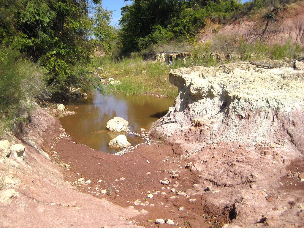
 Loc: Parker Co., Texas (Tin Top Rd). |
 Loc: Parker Co., Texas (Tin Top Rd). |
|
 Loc: Jack County, Texas. |
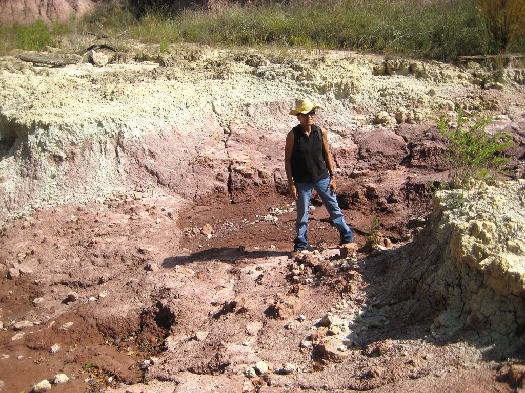 Loc: Jack County, Texas. |
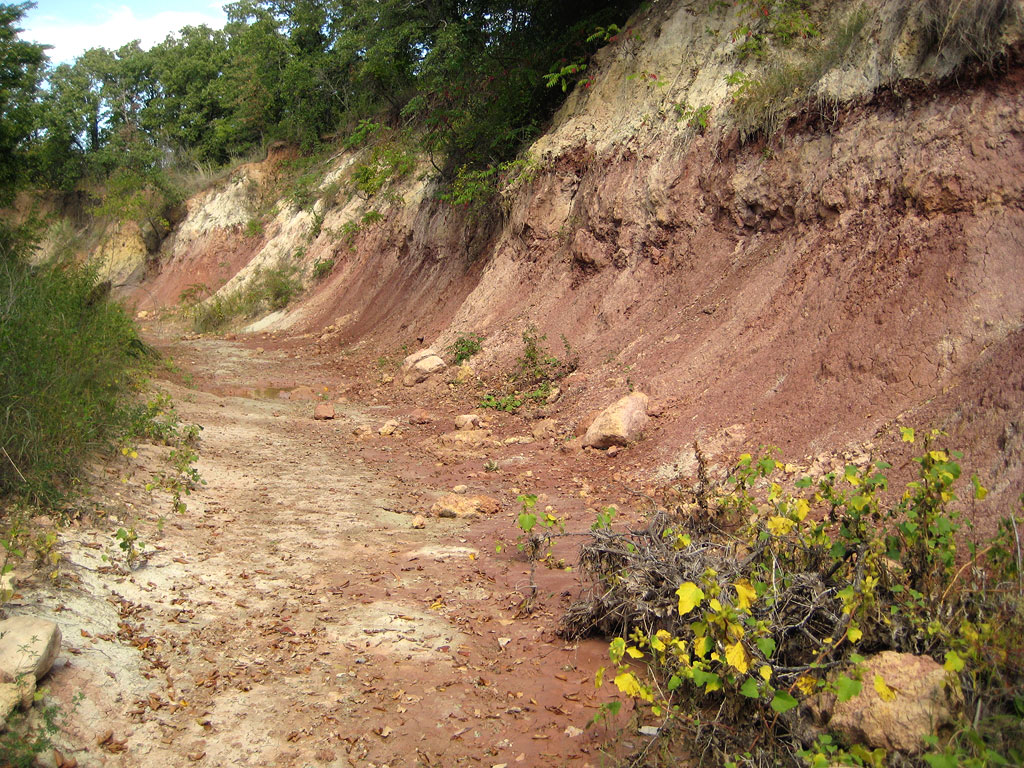 Loc: Jack County, Texas. |
 Loc: Jack County, Texas. |
 Loc: Jack County, Texas. |
| The Geology of Texas - Vol. 1 - pages
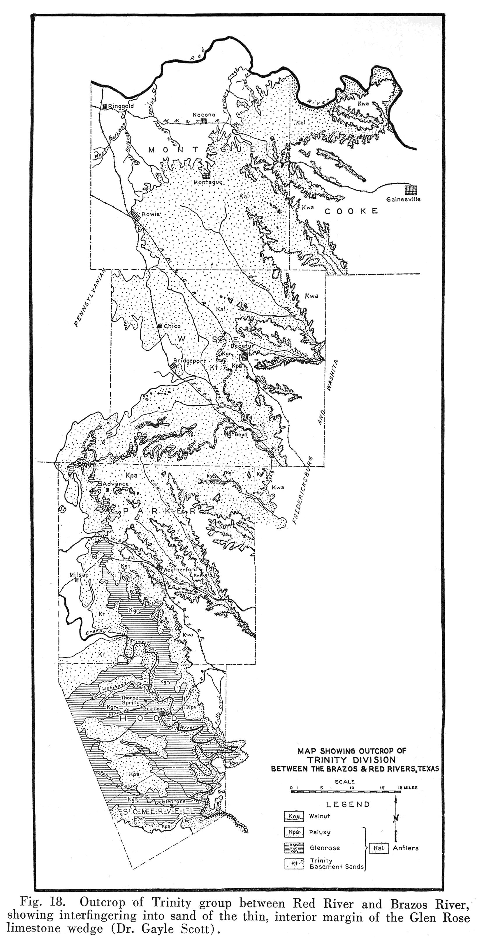
Travis Peak Formation Nomenclature. -- The Western, or Upper, Cross Timbers, underlain in part by the Travis Peak formation, was known to certain early explorers and writers (1329, 1463), but only in 1887, when studied at localities near Millsap, was it formally recognized by the name "Dinosaur sand" (731, pp. 301-302). The names "Trinity sand" and "Trinity division" were first applied by Hill in 1889 (735, p. 219), the type locality being in western Travis County. Stratigraphy and Contacts. -- The Travis Peak formation rests on early Cretaceous beds in the Malone and Quitman mountains districts. In the Rio Grande embayment and in Louisiana its substratum is unknown. Elsewhere in Texas it rests unconformably on a folded and eroded basement of pre-Paleozoic, Paleozoic, or Triassic formations. In a few places within its extent, it is locally absent: in part of the Llano-Burnet area, in the lower Pecos valley, in the northern Marathon basin. In some Denton County wells it rests on Ellenburger. Its upper contact has not been well studied. In north central Texas, and generally, where the Glen Rose limestone is absent, no line can be drawn between it and higher Trinity sands. Scott states that its top is laterally continuous with outfingerings of Glen Rose. Data on the deep offshore zones of the Glen Rose (Louisiana, Chittim structure) have not been published, and it is not known whether they coincide with some zones referred to the Travis Peak in the marginal areas or not. Facies. -- Nearshore, the formation consists of packsands, grits, sandy clays, sandstones, conglomerate, and gravel. Offshore, it consists of sandstones, sands, sandy clays, thin seams of limy rock, and at the base a variable thickness (50 feet or less) of grits and conglomerates with subangular quartz grains and rounded quartz pebbles up to an inch long. Most of this material is the marginal, in part littoral, deposit of an advancing sea; other more limy and shaly beds are a part of the neritic facies. Areal outcrops, local sections. -- In the Red River region the Antlers sand, the sandy equivalent of the entire Trinity group, consists predominantly of poorly cemented or uncemented packsand. At Rock Bluff ferry, northwestern Cooke County, the base of the Trinity consists of 16 feet of gravelly conglomerate of chert and quartz pebbles up to 3 inches in diameter, and fine to coarse, poorly cemented, light colored sand. This is followed by about 68 feet of packsand, containing at places limy streaks, irregular concretions, layers of yellow to purple clay, and, near the top, some thin layers of gypsum. This is capped by a 3-foot, hard, pebble, conglomerate bed. Between Warren's Bend and Sivell's Bend (Bullard, Okla. Geol. Surv., Bull. 33, p. 21, 1925), there is a section of 181 feet of upper Trinity overlain by Goodland limestone. It consists of packsands and hard sands (mostly of light colors), some sandstone, and clay. In the upper part of the section, Exogyra texana Roemer and Ostrea crenulimargo Roemer, occur. On a tributary of Little Mineral Creek 4 miles north of Fink, 123 feet of Trinity is recorded (177, p. 17). It consists of light colored packsands with some clays, conglomerates, and limy streaks. The formation contains locally large amounts of fossilized logs and driftwood. Grayson County wells have almost a thousand feet of Antlers. In the city of Sherman well it is 953 feet thick and is largely packsands and sandstones, with some shale and sandy shale near the base. Red color is scattered throughout, except near the top. Water horizons are logged about 200 feet below the top, and at many levels near the bottom. In Montague County (176, p. 69) the basement sand of the Trinity is about 600 feet of clean packsand and conglomerates with seams of clay. The fine, white to yellow, massive packsand occurs in beds up to 40 feet thick. Lentils, of yellow, purple, or varicolored clays, scattered throughout the Trinity, have a thickness ranging from a few inches to 40 feet. The basal Trinity consists of a quartzose conglomerate, about 3 feet thick, composed of well rounded quartz grains and pebbles up to an inch in diameter, with practically no mud or silt in the matrix. Near Montague and Bowie there are more than one of these thin basal conglomerate seams. In Wise and Parker counties, the basement sands and conglomerates reach 150 feet in thickness. The basal conglomerate consists of quartz sand and pebbles up to 3 inches in diameter, with little siliceous or calcareous cement, or, more generally, uncemented. These rounded quartz gravels are not derived from the underlying angular and heterogeneous Pennsylvanian conglomerates. The basal conglomerate grades upwards into unconsolidated white packsands, and thence into the sandy clays, and limestones of the Glen Rose. Locally the basal Trinity, like the Paluxy, contains red beds. Near the village of Brock there is a local concentration of salty sand which contaminates wells and makes the soil unusable (1394, p. 39). Along the strike in Cooke, Denton, and Tarrant counties, the basement sand maintains a thickness of around 400 feet (Fig. 17), but down-dip it thickens somewhat (550 feet at Dallas, several hundred feet south of Mexia). From the Brazos River valley to the Colorado River valley, the western border of the Comanchean lies only slightly west of the farthest extent of the thinned Glen Rose limestone. Therefore to the west of this border the outliers of the Trinity group consist only of sandy deposits overlain by Fredericksburg clay and limestone, as at Santa Anna and in the Callahan Divide. From the Brazos Valley the Trinity border passes in a southwesterly direction across northern Erath and Comanche counties to the northern part of Brown County. Thence the margin follows southwards along high bluffs on the east side of Pecan Bayou to the Colorado River valley near Marble Falls (449, pp. 360-371). The basal Comanchean conglomerate and sands show two outstanding features: (1) they were deposited on an irregular Paleozoic floor, and change rapidly in thickness; (2) the basal conglomerate consists largely of materials derived from the immediate vicinity, and is more limy in the south (Burnet, San Saba, McCulloch counties) where the hard Ellenburger and Bend limestones furnished resistant materials, more sandy in the north (Brown, Eastland, Comanche counties) where the Paleozoics contained more soft sandstones, clays, and some limestones. From Comanche County, at Round Mountain, Hill (803, p. 207) gives a section of about 247 feet of sand, sandy shale, and thin conglomerate below the Glen Rose limestone. Along Rusk Creek north of Comanche the 50 to 75 feet of basal Comanchean is composed largely of a conglomerate of siliceous pebbles and grit of white (occasionally red) quartz grains (449, p. 364). At nearby localities the conglomerates in the basal
Trinity sands and grits are very thin and local. In the escarpment east of Pecan Bayou, on account of the irregularity of the Paleozoic floor, there is a variable amount of basal conglomerate, 20 to 30 feet, overlain by red, pink, or yellow friable sandstone and grit, and by sandy limestone, followed by sands and sandy clays to a total thickness of 100 feet or more. Near Nix, Lampasas County (449, p. 364; 803, p. 181), the basal conglomerate, 20 feet thick, contains pebbles of Paleozoic limestones, quartz, flint, and other materials, cemented in a matrix of argillaceous and arenaceous lime. It is followed by 30 feet of lime-cemented packsand and grit, then 20 feet of calcareous sandstone. Locally north of this point the basal conglomerate reaches 100 feet in thickness and is followed by as much as 100 feet of packsand. Colorado River section.—Near the type locality, Travis Peak, basal sands are over 250 feet thick, and thin westwards. The basal conglomerates and sands have here been called the Sycamore sands by Taff. They typically consist of about 50 feet of basal conglomerate followed by cross-bedded calcareous shell grit. They contain the basal Trinity artesian water reservoirs in this immediate area. They are followed by the relatively impervious Cow Creek beds, about 30 feet of shale, grit, sand, and shell beds. Above these are the Hensell sands, typically 143 feet of red and yellow sand, conglomerate, and some limestone. This member contains the important middle Trinity aquifers. It is followed by yellow sandy fossiliferous (rudistid) basal Glen Rose limestone. The Leon sands in Comanche represent the local basement sands level. The Gillespie sands near Fredericksburg represent the entire local basal sands below the upper Glen Rose limestone, but may also be of Glen Rose age. Shorewards from Austin the Glen Rose thins rapidly, and the Trinity group is reduced to a thickness of 70 feet at Post Mountain, just south of Burnet. The Travis Peak formation, originally studied by Taff (1574), was partitioned into three members by Hill (803, pp. 141-144).
Cuyler (Thesis MS., 1931) reports three levels at which fossils occur: two in the Cow Creek member, and one near the top of the Hensell. A large fauna occurs in the Cow Creek beds, including Dufrenoya texana (Hill), D. justinae (Hill), D. roemeri, Pseudosaynella walcotti (Hill), Ostrea ragsdalei Hill,Trigonia stolleyi Hill(Hill, 755, p. 47; 783; 803, p. 161, pi. XXI; Cragin, 324).
|
|||||||||||||||||||||