|
The Geology of Texas - Vol. 1
WENO FORMATION
Nomenclature. -- Hill (788, p. 329) used the term "North
Denison sands" for all strata between the top of the Denton Gryphaea
shell aggregate and the base of the Pawpaw formation. Taff (1575, p. 273)
used for the Weno the term "Denison" marl, a name preoccupied
for the "Denison subgroup" in Hill's earlier papers. The term
"Weno subgroup" was used by Hill (803, pp. 269-271, 274 ff.) to
include the Weno and Pawpaw formations, and the term Weno formation (803,
p. 275) for the same strata as his original North Denison sands (his beds
j-m) . It is in this last sense that later writers have used the term
Weno. The type locality is near the abandoned village of Weno, on Red
River about 5 miles northeast of Denison.
Stratigraphic position and contacts. -- Stephenson (1530, p. 142)
records that in the Saint Louis and San Francisco Railway cut, 3/4 mile
north of the Union Station at Denison, the basal 3 to 12 inches of the
2-foot Quarry limestone is conglomeratic, containing scattered pebbles of
water worn calcareous sandstone, sandy lime-stone, and calcareous and
ferruginous concretions, the largest 3 inches or more in length. A few
borings filled with characteristic Quarry limestone material occur in the
top of the underlying Weno clay, and otherwise the Quarry overlies the
Weno with a sharply defined contact. In the absence of contrary evidence,
this indicates that the Quarry is better classified with the Pawpaw beds.
In Tarrant County this contact shows a sharp lithologic break, but no
other evidences of unconformity are reported. The Denton-Weno contact is
concordant and may be conformable.
Facies. -- In the Denison, the southern Oklahoma, and the El Paso
sections, the Weno is somewhat sandy. Its sediments in general are marl
and limestone, of the neritic facies, with ironstone and ferruginous
concretions. Near Fort Stockton a thin interfingering of Toucasia reef
limestone occurs.
Areal outcrop; local sections. -- In Love County, Oklahoma, the Weno
consists of dark blue clay with many ironstone and ferrruginous sandy clay
concretions, and segregations of mineral salts. It contains fossils,
nacreous, and in the form of ironstone casts and impressions. It is 90
feet thick in southwestern part of Marshall County, and 135 feet thick in
the northern part. Here the Weno contains many thin soft sandy layers and
clay ironstone concretions. The northward increase in thickness is mostly
in the sandy layers, which on the south limb of the Preston anticline
average only 2 inches in thickness, but on the north limb, as at a
locality 3 miles east of Kingston, are several feet in thickness. The
sandy, ferruginous Quarry limestone maintains a thickness of 2 to 3 feet
in this area. Several similar indurated layers occur in the lower Pawpaw;
and in the Weno, 20 to 30 feet below the Quarry, there is a persistent
hard, sandy limestone about a foot thick, weathering yellowish-white and
resembling the Quarry. In Grayson County, there is about 117 feet of the
Weno, consisting principally of clay; it is composed of dark gray shaly
clay with subordinate thin partings, lenses and layers of fine,
gray-to-yellow sand and sandstone, and, in the upper part, many small
flattish ferruginous concretions and some small marcasite concretions. On
the north limb of the Preston anticline, in the left bank of Washita
River, 2¾ miles west of Platter, Oklahoma, there is a layer of sandstone
5 or 6 feet below the Quarry limestone and several layers of thin flaggy
sandstone (25 to 40 feet below the Quarry. On the north limb of the
anticline, in Marshall County, the Weno is 135 feet thick (1530, p. 141).
At level about 44 feet above the base, in Duck Creek, north of Denison,
there is a layer of large (4 to 5 feet in diameter) indurated and
laminated ironstone concretions ("niggerheads"). Above these the
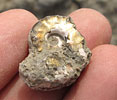
nacreous ammonites (Engonoceras serpentinum) are most abundant. In
the upper 50 feet of the formation, as seen in cuts a mile north of
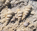
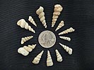
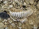
Denison, there are many nacreous shells (Turritella, Nucula,
Yoldia, Corbula, and others).
In Cooke County the Weno is 100 feet thick. In Denton Creek, east of
Justin, the upper 42 feet is exposed; in the northern part of the county
near Sanger it is 105 feet thick, and in the southern part, west of
Roanoke, 66 feet thick. On Clear Creek, Hill records 81 feet of Weno (803,
p. 275) ; limestone seams are already appearing in this section.
In the Tarrant County section of the Weno, limestone is the dominant
material. The formation is 67 feet thick. The basal 15 feet is a blue
clay, capped by two marly limestone ledges, containing Gervilliopsis
and other fossils. This portion is very fossiliferous, and locally
contains a zone of abundance of Turritella wenoensis (T.
ventrivoluta Cragin?) and Pecten georgetownensis Kniker. The
medial portion consists of 34 feet of marl and some soft limestone, with Haplostiche
texana (Conrad) in its upper part. The upper 18 feet beneath the
Pawpaw is medium-bedded, marly, grayish-white limestone, with subordinate
marl layers, containing Macraster obesus Adkins and other fossils;
it makes a distinct bench. These portions of the Weno are well exposed on
Sycamore Creek. The Quarry limestone is not recognizable. In Johnson
County 40 to 50 feet of Weno occurs. The upper one-half is mostly
limestone, with subordinate marl seams, containing Pervinquieria
wintoni, Pecten georgetownensis, Haplostiche texana, and
other local markers. The lower one-half is marl with limestone seams. In
McLennan and Bell counties it is reduced to 20 to 30 feet, and consists of
limestone in thin to medium beds with slight marl interbedding. At Austin
(803, p. 265) the Weno is probably represented by less than 10 feet of
limestone (Hill's bed 6, on sect 29) . South of Austin it has not been
traced.
At Fort Stockton, the Weno, lying between the middle and upper cap rocks,
is represented by 81 feet of marly limestone, marl, yellowish sandy
limestone, and sandy marl. These strata contain a prominent ferruginous
flint layer near their top. Fossils are: Haplostiche texana, Pervinquieria
aft. wintoni, and a zone of Toucasia in a thin reef
limestone finger near the middle. The section at Kent is similar. At El
Paso the Weno is blue clay basally, with pyritic micromorphs (Pervinquieria
n. spp., Neokentroceras?), and sandy clay above, with Alectryonia
quadriplicata.
Paleontology. -- In the upper Washita, as in the upper Albian, quadrituberculate Pervinquieria (P. wintoni group) appear.
Several species are known from the Denton onwards: P. wintoni is
wide-spread in the Weno and is a practical marker; new species of the P.
kiliani group occur; Prohysteroceras occurs; Macraster
obesus is a practical marker.
Miss M. J. Rathbun has identified from Weno material in the Bureau of
Economic Geology the following macrourous crustacea: Enoploclytia
n.sp., Palaeastacus walkeri (Whitfield) ; the latter species occurs
also in the Fort Worth formation and in the Fort Worth portion of the
Georgetown.
Foraminifera from Weno
formation
(Sycamore Creek, east of Katy Lake, Fort Worth) |
Gaudryinella delrioensis Plummer
Lenticulina washitensis (Carsey)
Saracenaria sp.
Vaginulina recta Reuss
Dentalina spp.
Nodosaria obscura Reuss |
Lagena sulcata (Walker and Jacob)
Dentalinopsis excavata (Reuss)
Gyroidina nitida (Reuss)
Anomalina falcata (Reuss)
Globigerina washitensis Carsey |
|
 [+]
[+]

 [+]
[+]
 [+]
[+]
 [+]
[+]