|
The basal member is four feet thick at the first locality, two feet
thick at the second. At both places it consists of gray to buff-weathering
gritty and pebbly marl, the visible constituents consisting of fish teeth,
fish vertebrae, and dark internal molds of gastropods and pelecypods.
These fossils are most abundant along the base where they form thin
conglomeratic lentils in places. |
||||||||||||
Geology Pictures: |
||
Pinnacle park quarry cut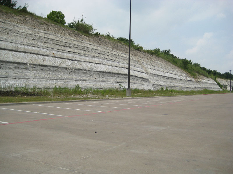 |
same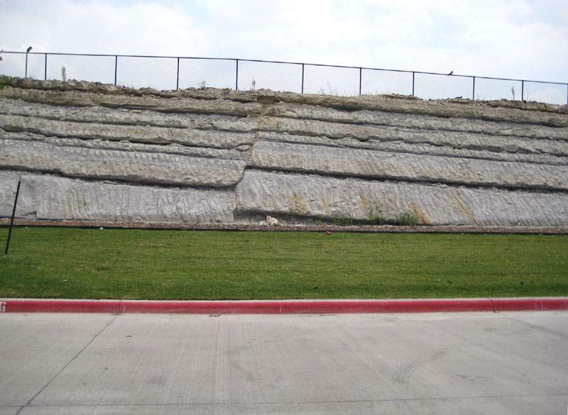 |
 |
 |
 |
 |
Fossil Pictures: |
||
Inoceramus sp. clam (impression)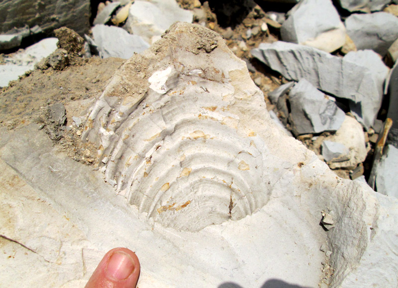 Formation: Austin Period: Cretaceous Loc: Collin co., Tx. Aug. 2, 2014. |
Inoceramus sp. clam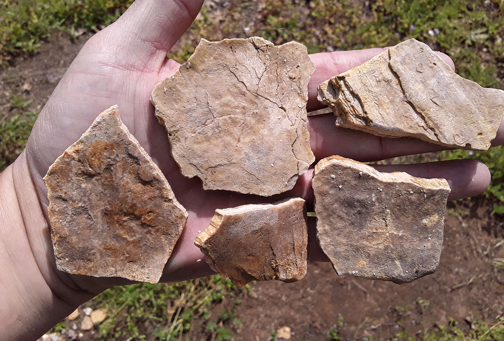 Formation: Austin Chalk Period: Cretaceous Loc: Collin County, TX. 2023. |
Inoceramus sp. clam Formation: Austin Chalk Period: Cretaceous Loc: Collin County, TX. 2023. |
|
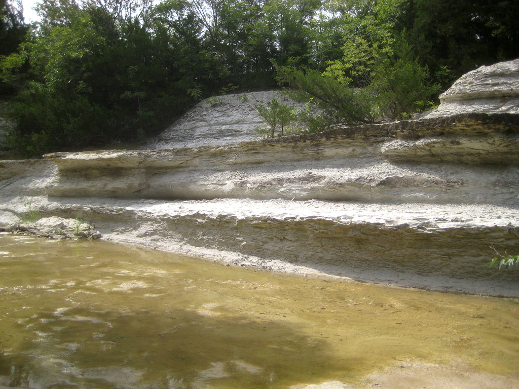
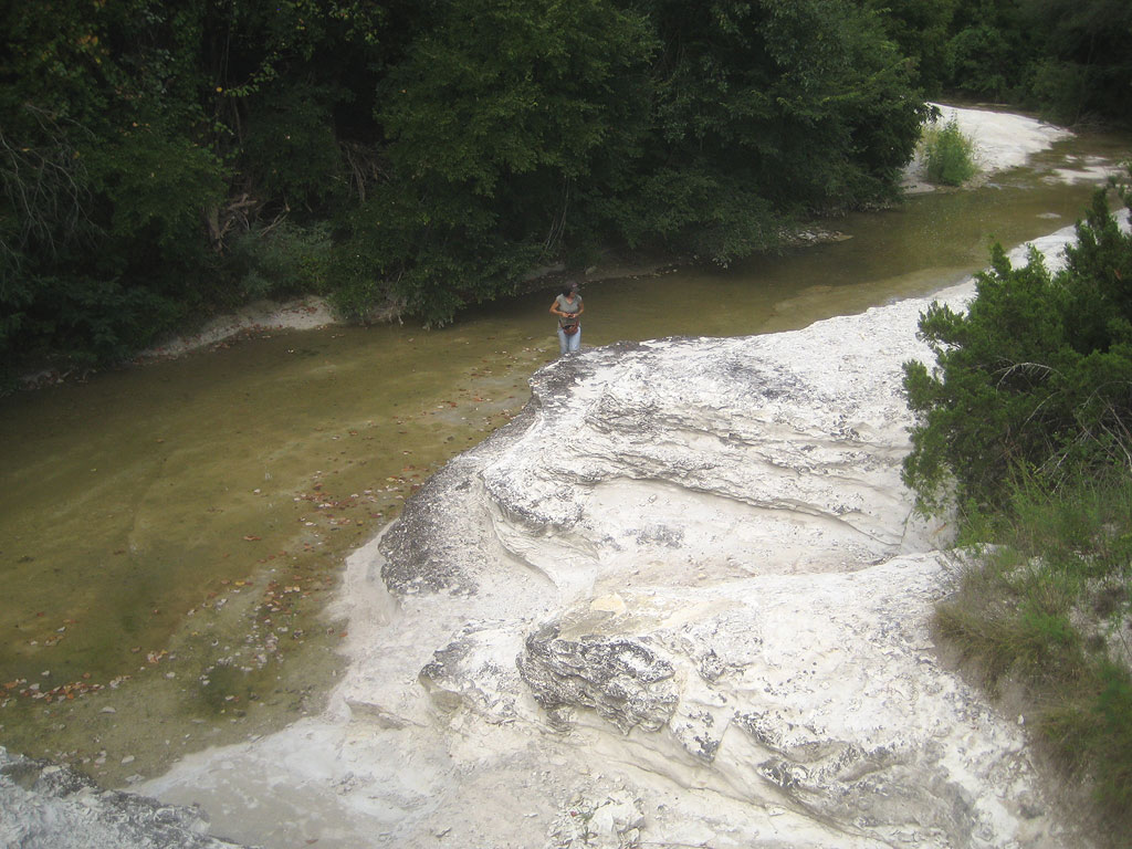
BLACK PRAIRIE REGION - TYPICAL AUSTIN CHALK Although the literature contains records of 350 to 400 feet of Austin in Bexar County, many geologists now consider that these thicknesses include some rocks of Taylor age. The Austin chalk is stated to be 110 feet thick in eastern Bexar County [L. W. MacNaughton, personal communication], and the 443 feet of Austin recorded (888) in southwestern Bexar County is stated to include the Anacacho. Likewise it is unknown how much, if any, of the upper part of the type Austin chalk in Travis County should be separated from the true Austin. These questions require extensive zonal work and a paleontological redefinition of the type sections. At the type locality the lower two-thirds of Austin
consists of irregular strata of variable thickness, from thin-bedded to
massive, and with often indefinite limits, generally alternately harder
and softer. They are composed of a gray-white chalky limestone in the
harder layers, and a dark blue or blackish marly limestone or limy marl
weathering dead white or light gray, and in texture unevenly flaky or
laminated. A few of the limestones are indurated, some are shelly. Some
contain much debris of oysters, inocerami and other shells. At certain
levels considerable glauconite, dispersed as small specks, occurs; the
formation contains imbedded balls, cylinders and irregular botryoidal
masses of pyrite with radiating internal structure; and locally veins,
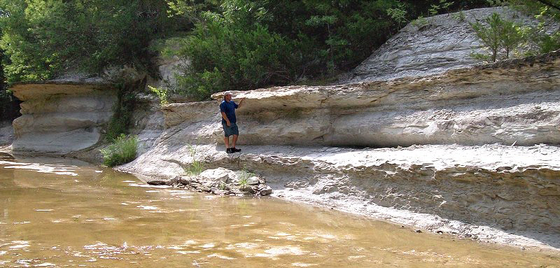
seams and joint cracks filled with calcite. In youthful stream cuts
vertical cliffs of alternately projecting and receding strata occur; on
hillsides and upland prairies a rounded topography prevails. On many
patches of upland, headwater erosion is sufficiently rapid to strip the
outcrop of soil. The Austin consists of beds of impure chalky limestone, containing 85 per Cent or more of calcium carbonate, interstratified with beds of softer marl. It is usually of an earthy texture, free from grit, and on fresh exposure softer, so that it can be cut with a hand saw, but on exposure more indurated. In thin slices the material shows calcite crystals, particles of amorphous calcite, finely crystalline calcareous material, foraminiferan shells and fragments, fragments of the prismatic layer of Inoceramus often in great abundance, debris of pelecypods, gastropods, echinoids, and other organic fragments. The material has the typical crystalline structure of limestone. Some slices show abundant glauconite specks; some show a sparse to medium amount of "spherical bodies" (see page 365) ; and some show a finely crystalline texture almost devoid of organic material. Typical analyses show calcium carbonate 82 per cent; silica and insoluble silicates 11 per cent; ferric oxide and alumina 3 per cent; magnesia 1 per cent. The water-filled subterranean chalky limestone is
usually of a blackish-blue to bluish-gray color, as in most cores. The
air-dried material is generally glaring white and of a matte texture. The
dried marls may be more blackish or bluish. They weather mostly into
abrupt slopes capped by harder ledges. Some ledges become indurated and
crystalline; others, less crystalline, weather into irregular small
conchoidal flakes with an earthy fracture. The harder strata have an
irregular, ragged conchoidal fracture. Locally in the more massive layers,
there occurs a large conchoidal flaking, superficially resembling
exfoliation. On prolonged disintegration, the Austin weathers into a black
residual soil, characteristic of the Black Lands belt of east-central
Texas. Locally as near Pilot Knob, the Austin is metamorphosed, and occurs
as a porous, redeposited and recrystallized limestone in medium beds, soft
enough on fresh exposure to be sawed, nearly pure, and producing an
excellent building stone. The German Lutheran Church just north of the
Capitol at Austin is built of this stone. Formerly the ordinary Austin was
somewhat used as a building stone, but its softness, marly partings and
iron stain make it less desirable than other stones available in central
Texas. The middle part, about 250 feet thick, has fewer massive layers, and is characterized by thick, and often indurated shaly layers which show a fine lamination. This part does not show in stream cuts as marked expression of projecting and receding layers as does the basal part. The uppermost part contains more shaly limestone and less chalk. The colors are predominantly blue and yellow. Some sandy strata occur. At the Austin-Taylor boundary, there is a sharp transition from massive flaggy chalk (containing "large ammonites,' most of them Parapuzosia) to gray shale, some of it calcareous. In the Waco region the basal chalk is well exposed
in Cameron Park. Here it consists of medium to thick massively bedded
strata with some alternating receding ledges. By undercutting of Bosque
River large blocks fall down the slopes and disintegrate. Flaking and
exfoliation are extensive. In the cuts of Brazos River across the Austin
chalk outcrop, considerable small scale faulting, with the development of
V- and A-shaped grabens and horsts, is present. Such local faulting occurs
in White Rock Creek near the Harrington well. |