Fort Worth Ls.
  Kiamichi Fm.

Duck Creek Formation
(c. 100-102 mya)

The Geology of Texas - Vol. 1

DUCK CREEK FORMATION

Nomenclature. -- The formation was named by Hill (722, p. 516; 780, p. 90) in 1891. The type locality is in Duck Creek, at the edge of Red River valley, about 3 miles north of Denison. The base of the formation (overlying uppermost Kiamichi), is exposed in the creek bed, and the remainder is exposed in the nearby railway cuts.

Stratigraphic position and contacts. -- The Duck Creek limestone overlies the Kiamichi marl as far south as Bell County. Farther south, the Kiamichi is absent and the Duck Creek, here the thinned basal member of the Georgetown limestone, directly and disconformably overlies the Edwards. The Duck Creek is everywhere overlain, apparently conformably, by the Fort Worth limestone.

Facies.—Throughout Texas, so far as is known, the neritic facies of marl and marly limestone prevails. In north-central Texas and northern Trans-Pecos Texas, the Duck Creek is more marly and its limestones more nodular than farther south.

Areal outcrop; local sections. -- Westward across Choctaw and Bryan counties, Oklahoma, the Duck Creek thickens till, in Love County, it has a thickness of about 120 feet (Bullard, Okla. Geol. Surv. Bull. 33, pp. 33-35, 1925). This consists of a basal 20 to 22 feet of alternating marly-chalky limestone and gray marl, the strata ranging from a few inches to 2 feet in thickness. Some of the lime-stone is partly crystalline, hard, white, with prominent conchoidal fracture and flaky weathering, somewhat like the Goodland. The base contains the Hamites zone, and Desmoceras occurs throughout this thickness. Overlying this is 56 feet of clay, as on Duck Creek. Then follow a 19-foot section of alternate thin clay and marly lime-stone strata, 17 feet of clay, and 8 feet of limestone and clay strata.  A succeeding 14 feet of clay may be uppermost Duck Creek, but is probably, a part of the Fort Worth limestone.

At the type locality on Duck Creek, the formation consists of about 120 feet of limestone and marl, as follows: (a) Basal 40 feet of thin strata of limestone (up to 1 foot each) and thicker limy marl strata, forming the creek bluff north of the railway; Elobiceras, Hamites and many other fossils occur in the basal part, overlying the Kiamichi with Gryphaea navia and Oxytropidoceras (Adkinsites) belknapi; the entire thickness contains Desmoceras and Bendanticeras and Pervinquieria, and at the top there is a prominent zone of Epiaster whitei Clark. (b) A medial 40 feet is clay, with several species of Pervinquieria, Gryphaea, echinoids, and limonite fossils in two or three layers (this is the type locality of those described by Scott, (1388). (c) An upper 40 feet of clay, blue shale, and a few, scattered, thin, limy, seams, is exposed in the railway cuts southeast of the main creek cuts; these cuts contain many fossils, including pyrite micromorphs (Pervinquieria and others). The Fort Worth limestone caps this section. In Cooke and Denton counties, the Duck Creek is about 100 feet thick; in Tarrant County, 62 feet; in McLennan County it is reduced to about 30 feet; in Bell County to about 25 feet; at Austin, to about 20 to 25 feet. Farther south it is consolidated with the Fort Worth limestone to form the lower Georgetown. At Fort Stockton, it is about 48 feet thick; at Kent, 50 feet; at El Paso, about 100 feet at Sierra Prieta, about 25 feet. The division into an upper, more marly, and a lower, more limy, portion persists from Red River to at least Johnson County. In the Cooke County section (189, pp. 23-24), the basal 25 feet is an alternation of limestone and marl seams, containing Desmoceras, and some other fossils: Pervinquieria, several species, Hamites, Inoceramus, Exogyra plexa, Gryphaea and Trigonia. At Fort Worth (1789, pp. 39-51), several local zones have been discovered in the Duck Creek; the lower 27 feet is more limy and includes the zones of Hamites, Desmoceras, Elobiceras (top), Pervinquieria shumardi-nodosa, P. kiliani, the local Kingena zone, and others. The upper, marlier, part of the Duck Creek includes the local zones of Scaphites worthensis, Kingena (upper), the tiny echinoid Goniophorus scotti Lambert, and the lower range of Pervinquieria maxima (Lasswitz) , Macraster aguilerae, M. texanus and others.


Fossil List:

List from Geology of Tarrant County with updated names.  Older names are in [brackets].
Pelecypods (oysters):
Lopha subovata [Ostrea subovata]
Rastellum carinatum [Ostrea sp.]
Gryphea corrugata Say. 
Gryphea washitaensis Hill 
Inoceramus comancheanus Cragin
Inoceramus munsoni Cragin
Amphidonte walkeri  [Exogyra americana]
Trigonia sp.

Pelecypods (scallops):
Neithea texanus [Pecten texanus Roemer] 
Neithea subalpina [Pecten subalpina Boese] 
Neithea bellula [Pecten bellula Cragin] 
Neithea wrightii [Pecten wrighti Shumard]  

Pelecypods (clams):
Pinna sp.
Lima wacoensis Roemer
Pholadomya sp.

Gastropods:
Turritella sp.
Gyrodes sp. [?] 
Pleurotomaria austinensis Shumard. 
Fusus sp. 
Cerithium sp. 
Crania sp.
Nerinea sp.
Turbo sp.
Tylostoma [Lunatia]
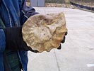
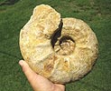
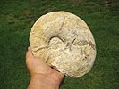
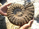
Ammonites:
Eopachydiscus [Desmoceras]
Mortoniceras [Schloenbachia]
Desmoceras-Pervinquieria ??
Oxytropidoceras (Adkinsites) diazi

Ammonites (heteromorph):
Idiohamites fremonti [Hamites]
Hamites spp.
Scaphites sp.
Turrilites sp.

Brachiopods:
Waconella wacoensis [Kingena wacoensis]
Kingena spp.

Echinoids:
Tetragramma [Diplopodia]
Hemiaster whitei Clark
Hemiaster sp.
Holaster simplex Shumard.
Macraster elegans [Hemiaster elegans Shumard]
Goniophorus scotti
Salenia sp.

Arthropods:
Callianassa sp. (crustacean burrows)

Vertebrates:
Fish teeth
Shark teeth

Geology:

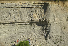
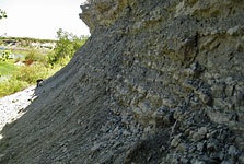
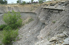
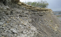
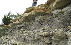
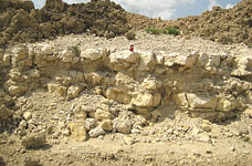
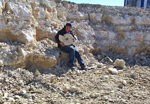
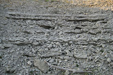
Upper marl layers:

Location: Tarrant Co., TX. July 12, 2008.

Location: Tarrant Co., TX. May 10, 2009.

Location: Tarrant Co., TX. Sep. 26, 2009.
The limestone at the top could actually be the Fort Worth Formation instead.

Location: Tarrant Co., TX. Sep. 13, 2008.

Location: Tarrant Co., TX. Sep. 13, 2008.

Location: Tarrant Co., TX. Sep. 13, 2008.
Lowest limestone layers:

Location: Tarrant Co., TX. July 22, 2007.

Location: Tarrant Co., TX. March 4, 2007.

Location: Tarrant Co., TX. Sep. 7, 2009.

Location: Tarrant Co., TX. Dec. 15, 2013.

Location: Tarrant Co., TX. Dec. 15, 2013.

Location: Tarrant Co., TX. Dec. 15, 2013.
     

Fossils:

Cephalopods: (ammonites)
unknown ammonite

Location: Tarrant Co., TX.
Eopachydiscus sp.

Location: Tarrant Co., TX.
Eopachydiscus sp.

Location: Tarrant Co., TX.
Mortoniceras sp. ammonite
[+]
Location: Tarrant Co., TX.
Eopachydiscus and unknown

Location: Tarrant Co., TX.
Eopachydiscus and Mortoniceras sp.

Location:  Tarrant Co., TX.
Idiohamites sp.

Location: Tarrant Co., TX.
  unknown ammonite

Location: Tarrant Co., TX.
Vertebrates: (sharks, fish)
Leptostyrax macrorhiza? shark teeth

Location:  Tarrant Co., TX.
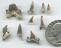
various shark teeth

Location: Tarrant Co., TX.
(Paraisurus, Paraptychodus, 3 Cretalamna)
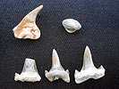
Location: Tarrant Co., TX.
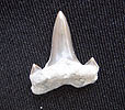
Cretalamna appendiculata

Location: Tarrant Co., TX.
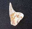
Paraptychodus washitaensis
[+]
Location: Tarrant Co., TX.
Paraisurus
[+]
Location: Tarrant Co., TX.
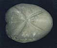
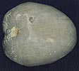
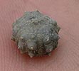
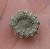
Echinoids: (sea urchins, sea biscuits)
Macraster washitae (top)
 
Location: Tarrant Co., TX.
Macraster washitae (bottom)

Location: Tarrant Co., TX.
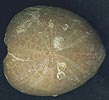
Goniophorus scotti (top)

Location: Tarrant Co., TX.
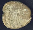
Goniophorus scotti (bottom)

Location: Tarrant Co., TX.
Holaster simplex (top)
 
Location: Tarrant Co., TX.
Holaster simplex (bottom)

Location: Tarrant Co., TX.
Gastropods: (snails)
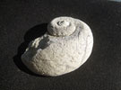
Gyrodes?
[by Roz]
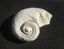
Gyrodes?
[by Roz]
 
Bivalves: (scallops, clams, oysters)
Neithea texanus scallop

Location: Tarrant Co., TX.
Neithea texanus scallop

Location: Tarrant Co., TX.