|
The Geology of Texas - Vol. 1
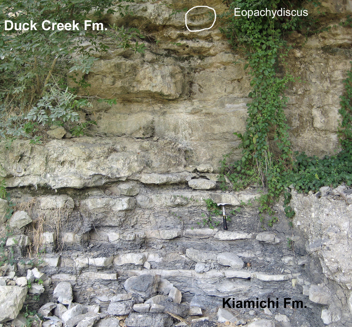
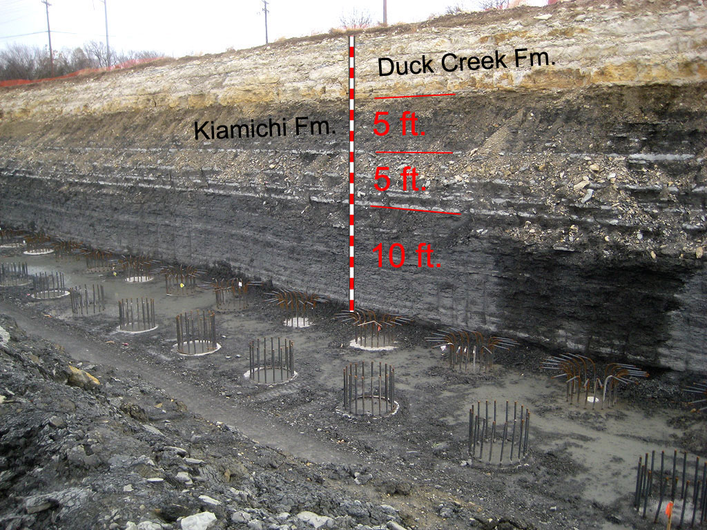
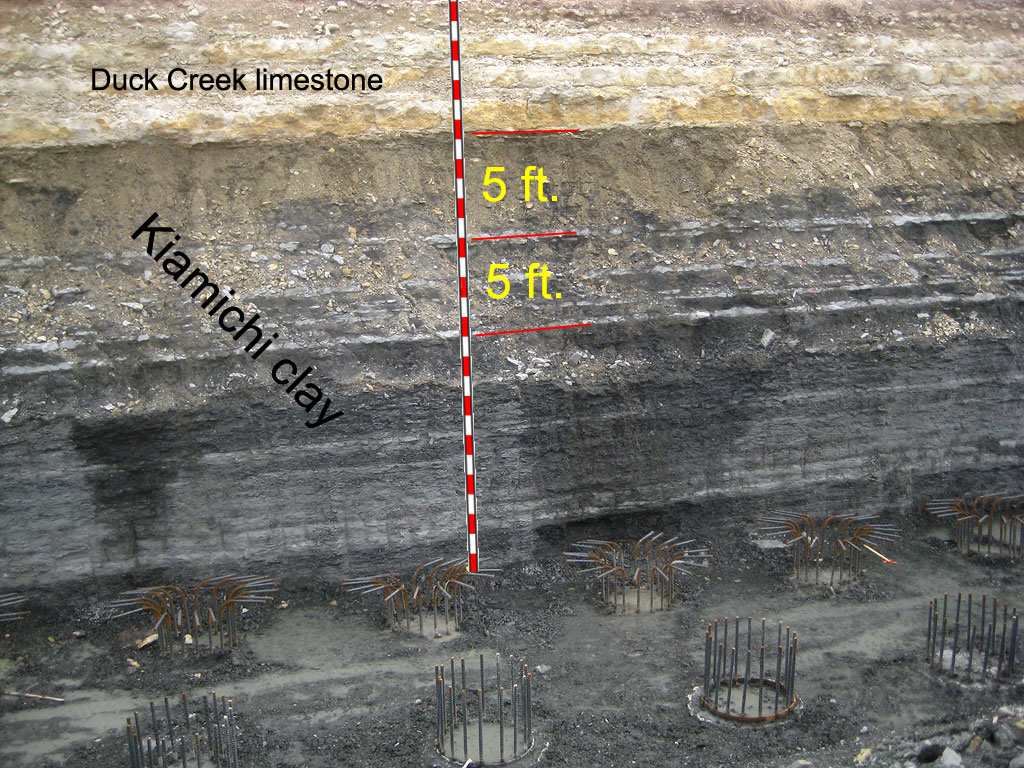
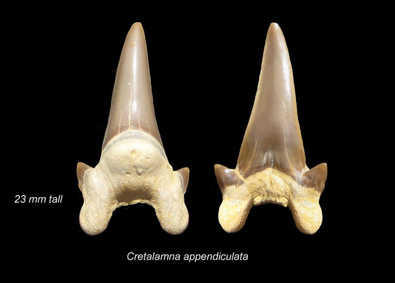
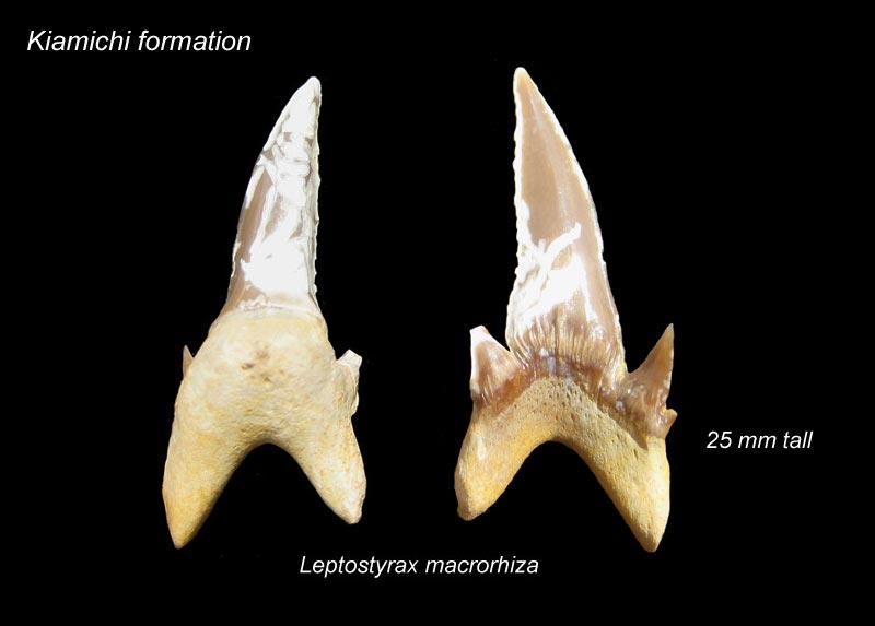
KIAMICHI FORMATION
Nomenclature. -- The formation was first called Kiamitia clays by
Hill (722, p. 515) in 1891. The present spelling is the product of the
Board of Geographic Names. The type locality is the plains of Kiamichi
River near Fort Towson, eastern Choctaw County, Oklahoma, though Hill also
mentions several typical localities west of that place.
Stratigraphic position and contacts. -- Information on the contacts
of this formation is meager. In the Fort Worth area, rounded pebbles have
been taken from the upper contact, and the washed material at this level
shows much grit and transported debris (Winton and Scott, personal
communication). South of McLennan County, the formation is absent, and
there are evidences of lack of conformity at the Edwards-Duck Creek
contact. Writers have noted the sharp lithologic break at the lower
contact, but definite records of the nature of this contact are lacking.
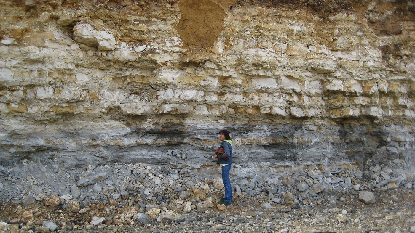
The formation is well exposed at Marshall's Bluff, Grayson County, and at
the Texas and Pacific Railway crossing of the Clear Fork, west of Fort
Worth.
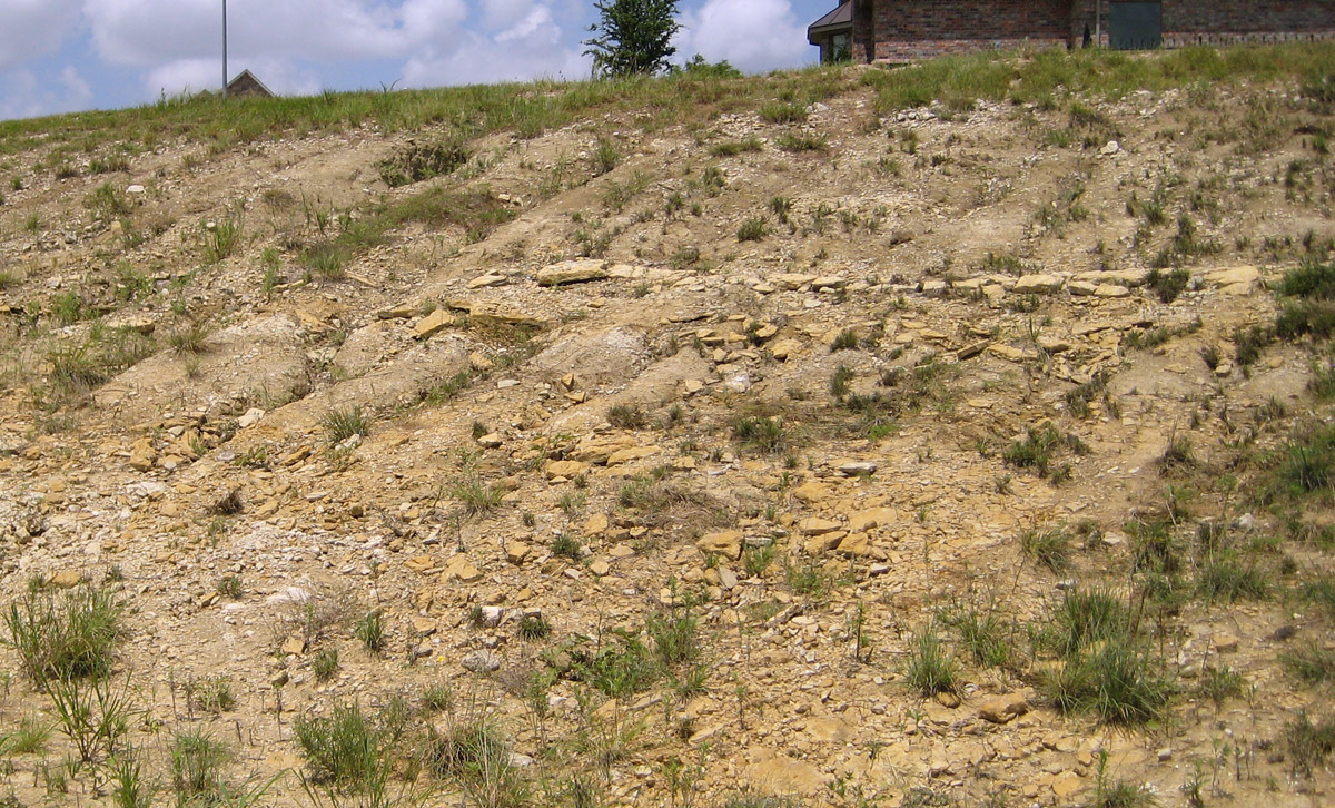
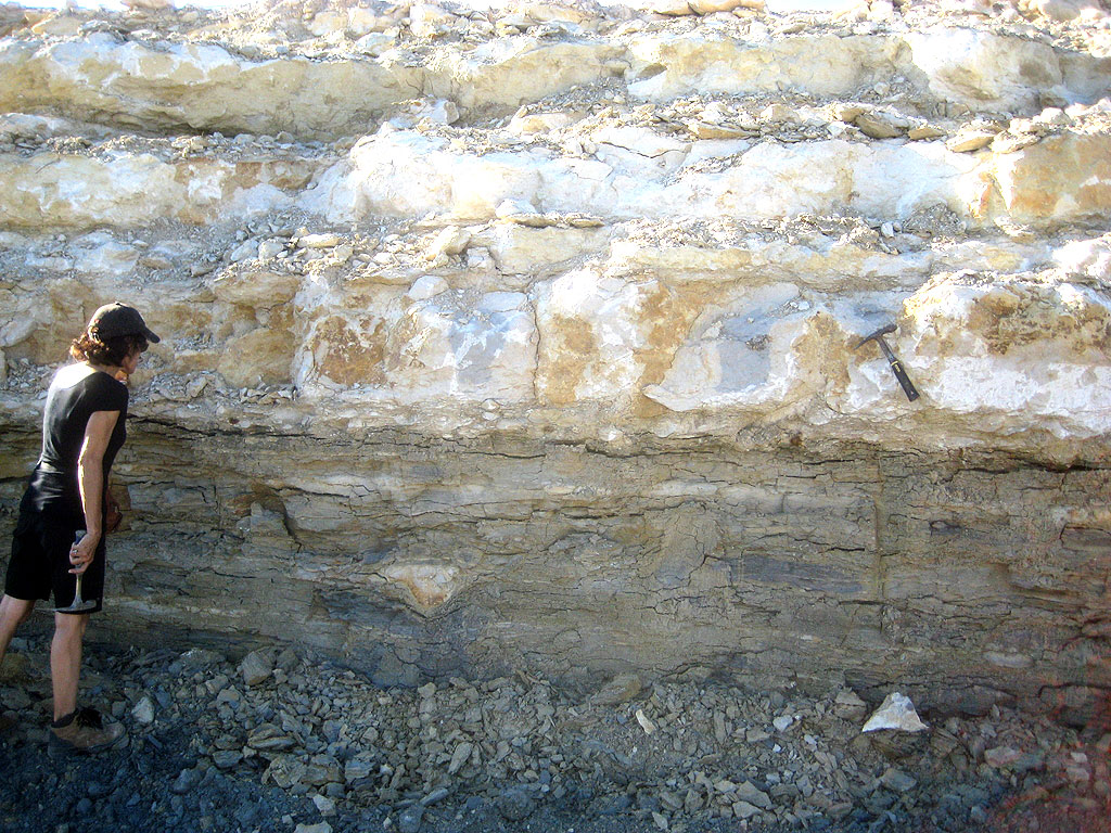
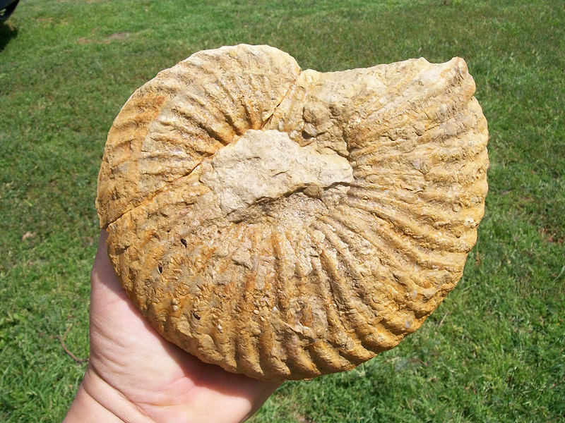
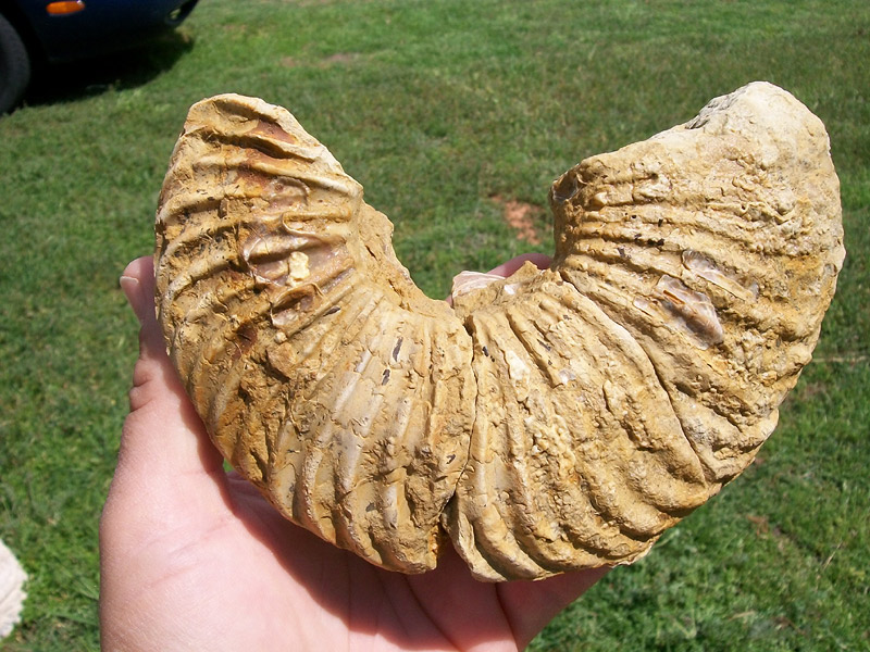
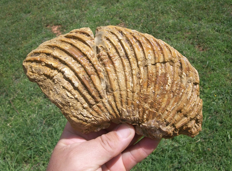
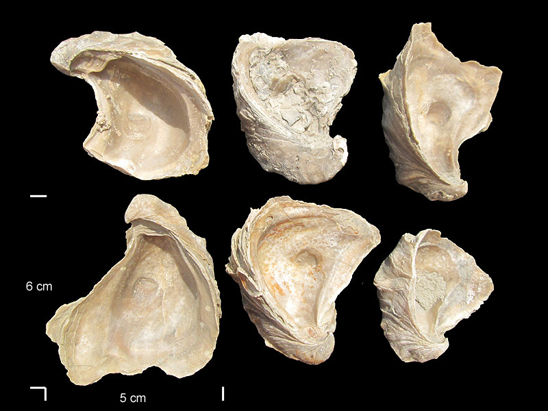
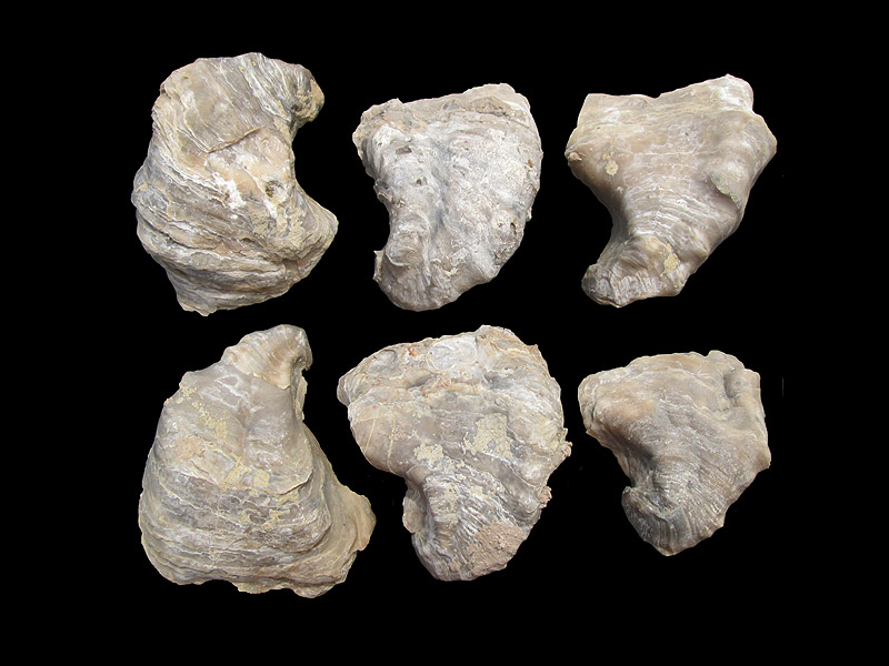
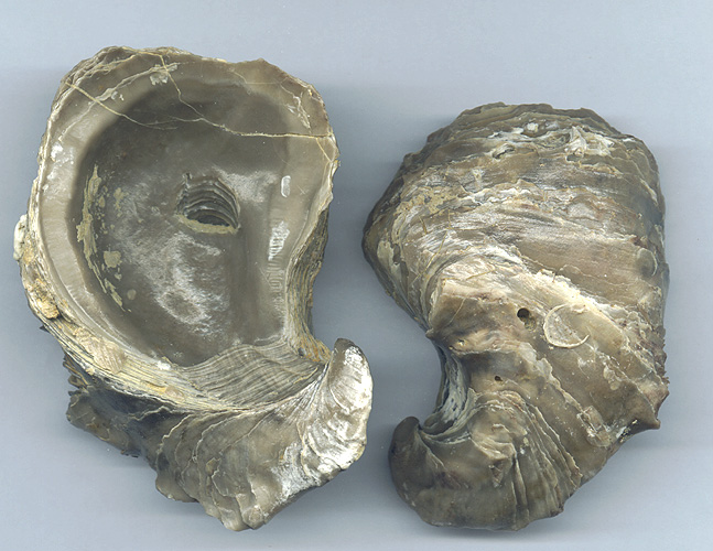
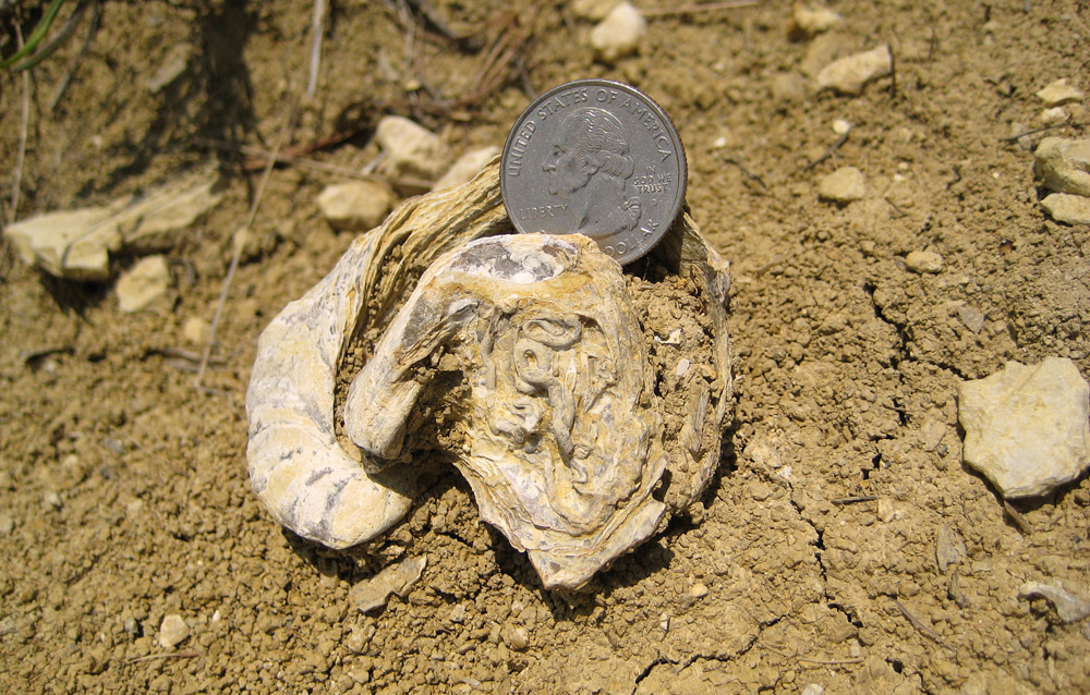
Facies. -- The formation, to its southern disappearance, is
neritic, and consists of marls, thin limestone seams, and shell aggregates
(mostly of Gryphaea navia Hall, some loose, some cemented). If the Sierra
Prieta sandstones below the Duck Creek Desmoceras zone include the
Kiamichi, it occurs there in the marginal facies.
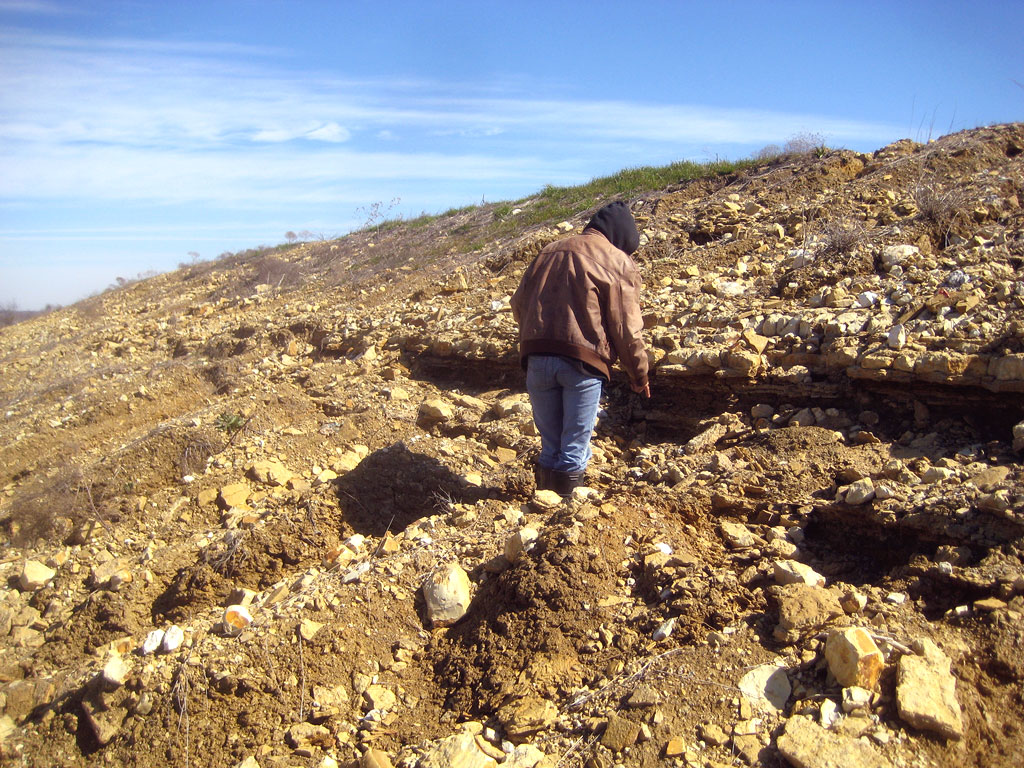
Areal outcrop, local sections.-- At the outcrop, the formation is
limited to central Texas north of the Brazos, and to the northern (more
neritic) facies in Trans-Pecos Texas. Its easternmost outcrop is at
Cerrogordo, Arkansas, its westernmost outcrop in Texas opposite the
smelter at El Paso. There may be equivalents in southern New Mexico and in
Arizona; its zone fossils occur near Lampazos, Nuevo Leon, and in the
Sierra de Tamaulipas, eastern Mexico. Northwards it occurs in the Texas
Panhandle, western Oklahoma, southern and central Kansas, Colorado, and
northeastern New Mexico. In wells it is practically unrecorded, except
near the outcrop.
One-half mile north of Cerrogordo, the Kiamichi consists of a few feet of
one-foot beds of closely packed gryphaeas, set in a scant matrix of dense,
hard, gray-green marl, and alternating with poorly exposed, softer, gray
and green marls, containing Gryphaea navia. One-half mile northeast of
Cerrogordo, 20 feet of Kiamichi consists of blue-gray and green-gray marls
alternating with discontinuous beds and lenses of gray fossiliferous
limestone. Near Goodland, Choctaw County, Oklahoma, Hill (803, p. 253)
records 150 feet of Kiamichi. The formation in this region consists of
shelly marl and indurated shelly limestone ledges in such quantity as to
be commercially suitable for lime and road metal. The formation, as in the
valley of Kiamichi River, contains countless Gryphaea navia and G.
corrugata, together with other undescribed fossils. The first
Comanchean fossil to be described from the Texas-Oklahoma region was G.
corrugata Say 1823, collected by the botanist Nutall in the lower
Kiamichi River valley; the second, Gryphaea pitcheri Morton 1834 (=G.
corrugata Say 1823) was collected in 1833 by Dr. Z. Pitcher from near
Fort Towson, eastern Choctaw County, Oklahoma (796, pp. 33-34). In Bryan
County, Taff records about 55 feet of Kiamichi (Taff, Atoka folio, No. 79,
p. 6, 1902); in Marshall and Love counties Bullard records 35 to 36 feet.
In Grayson County, thicknesses of 33 feet (803, p. 254), 36 feet (177, p.
25), 40 to 50 feet (844. p. 3), and 61 feet (Emil Böse, personal
communication) are on record. The upper ledges of the Kiamichi occur at
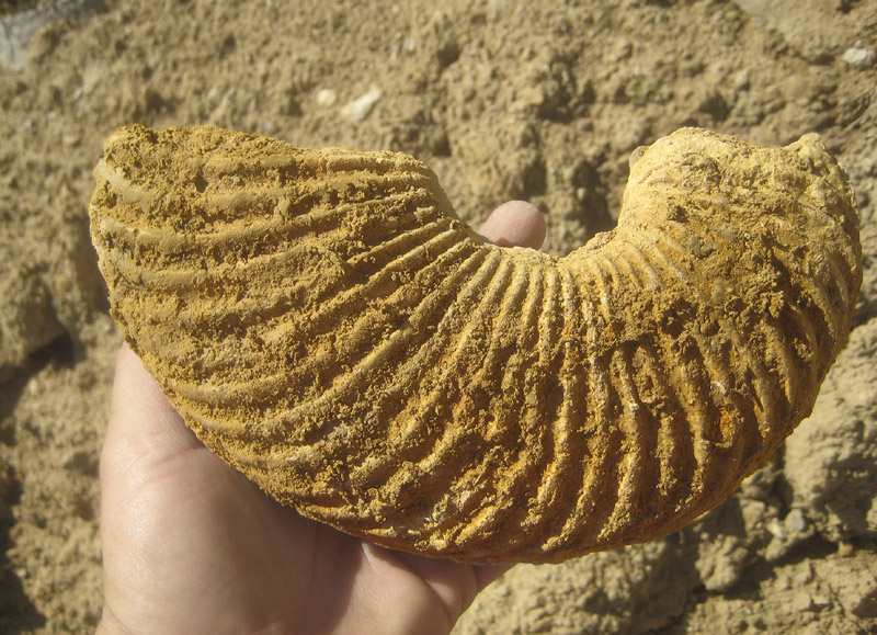
the Duck Creek type locality (803, p. 254), where the ammonite partition
(ranges of Oxytropidoceras, Adkinsites, Elobiceras,
and Pervinquieria) is well exposed. Along the outcrop to the
Brazos, the following thicknesses are recorded: northern Cooke County, 36
feet; 2 1/2 miles southwest of Era, 30 feet; southern Cooke County, 20
feet; western Denton County, 42 feet; Montague County, Sunset, 44 feet; at
Rhome, 35 feet; northwest corner Wise County, 22 feet; Dallas County,
nothing identifiable; Tarrant County, 27 feet; Johnson County, 18 feet;
near Blum, Hill County, 19 feet; near Mexia, 13 to 16 feet; Bosque County,
3.6 miles east of Valley Mills, 10 feet; at the McLennan-Bosque county
line, 9 feet; McLennan County, on the North Bosque, southwest of China
Springs, 5 feet; near Whitson, Coryell County, less than 5 feet; in Bell
County and southwards, unknown.
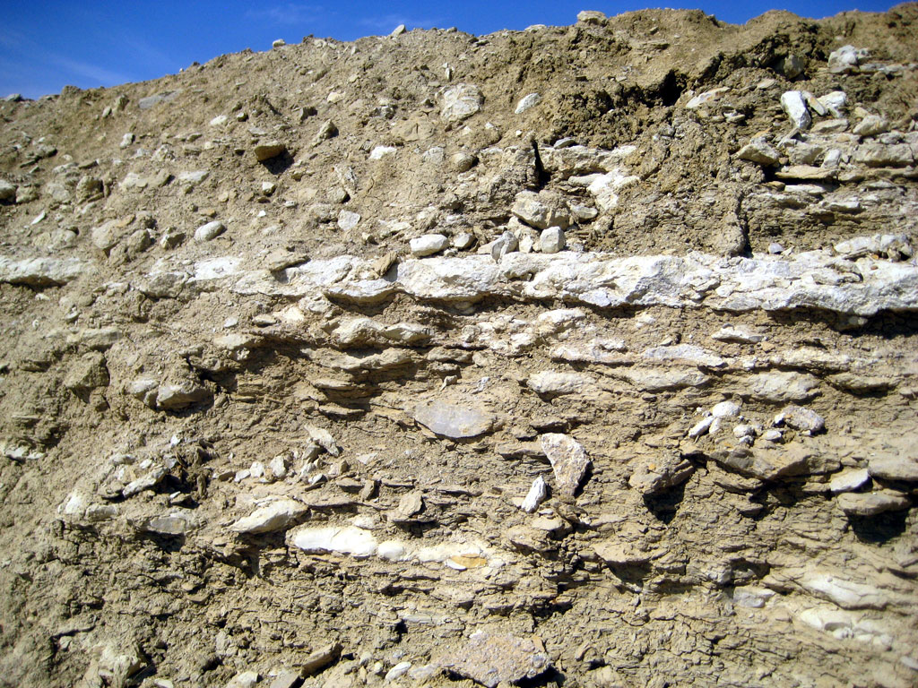
In Grayson County, the formation consists of an alternation of shale or
clay with limestone or shelly bands. The indurated calcareous clay occurs
interstratified with the dark blue clay; laminated limy flags in the lower
half and indurated Gryphaea shell-ledges in the upper half alternate with
the clay. In the northern area, the hard ledges are continuous between
exposures. They seem to be composed of Gryphaea corrugata Say, with
some other species less abundant. In Tarrant County the basal half of the
formation is marly. The next one-fourth contains 6 thin limestone ledges
alternating with marl. The top is marly, but on the Red River it is
shelly. Near Fort Worth, G. navia is abundant in the middle third,
and sparse above, but on Red River it forms shell aggregates in the top of
the formation. Exogyra plexa occurs in the base of the upper
one-third (and in the Goodland limestone). Oxy. belknapi, abundant
at Fort Washita and at the Duck Creek type locality, seems to characterize
the formation. Oxy. "acutocarinata" is also reported from
the formation. In the Fort Stockton area G. navia is confined to
the base, and G. corrugata is the abundant species above. South of Tarrant
County the shell aggregates largely disappear and the limy ledges are
reduced. Gryphaea corrugata, Exogyra plexa, and Oxy.
belknapi seem more frequent in the top; G. navia and Exogyra
texana in the base. Toward the Brazos, the dwindling Kiamichi is
reduced to a thickness of less than 10 feet, mostly of marl; its
southermost appearance is in Coryell County, near Whitson.
|
 [+]
[+]

 [+]
[+]
 [Roz M]
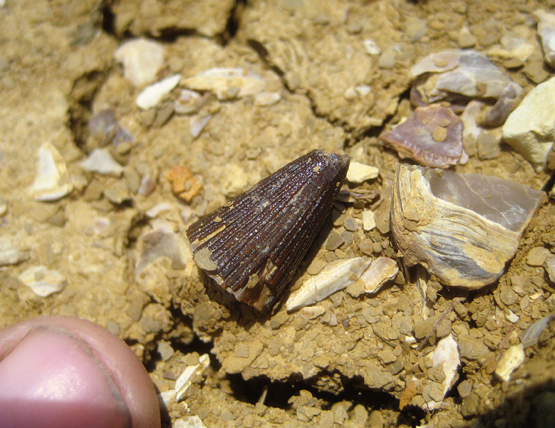
![[+]](fieldtrips/2008-01-26/2008-01-26-008-1000.jpg)
![[+]](fieldtrips/2009-11-06/2009-11-06-003-800.jpg)